
Salt Pond Carry-in Access near Falmouth
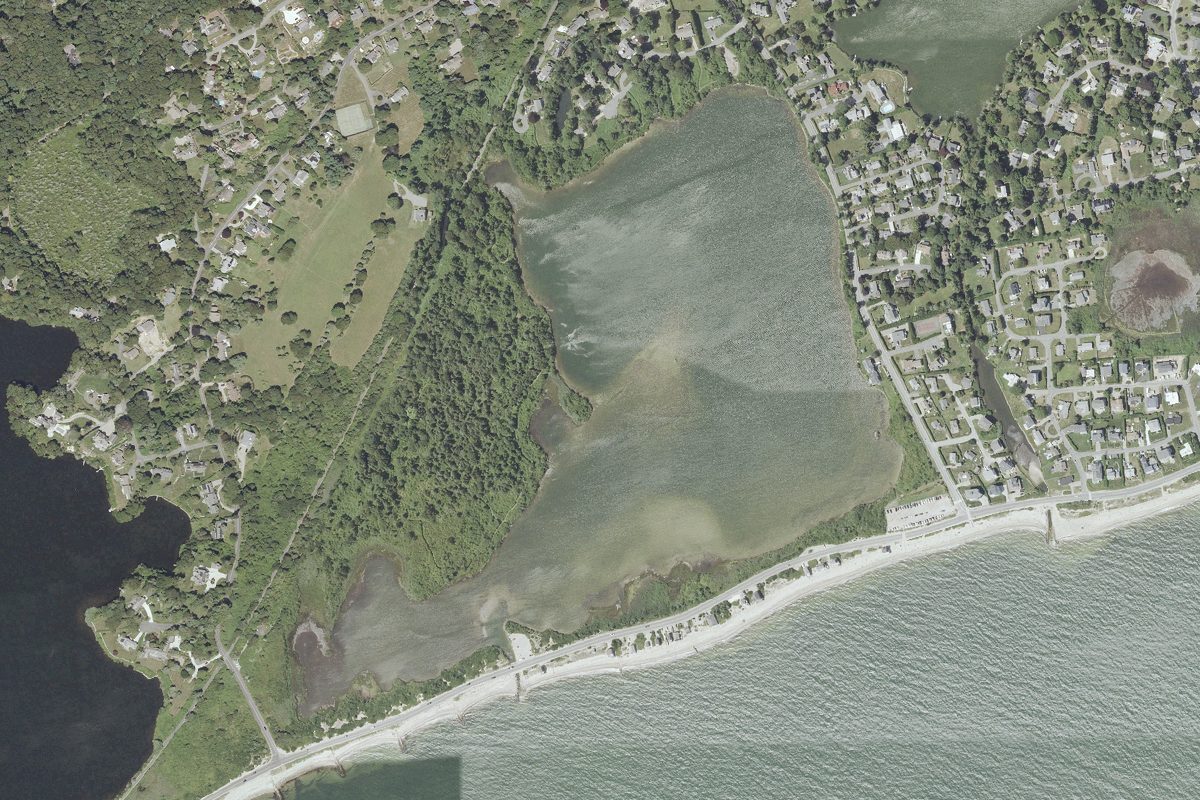
This is a public kayak and canoe launch on Salt Pond near Falmouth, Massachusetts, run by MassWildlife.
- Tidal
Status not reported No closure has been posted for this launch, but its agency does not publish open or closed status. Check with the managing agency before you tow.
At the launch
- Type
- Carry-in (canoe and kayak)
- Ramp surface
- Dirt
- Tidal
- Yes
- Managed by
- MassWildlife
- Coordinates
- 41.54168, -70.62425
Directions (Google) Apple Maps
This launch has no official name in our sources; the name above describes where it is.
Conditions
- Weather forecast for this launch · National Weather Service
- Tide predictions at Falmouth Heights · NOAA, 1.6 mi away
Marine advisories
Advisories in effect load here; without them, see the NWS zone forecast below.
National Weather Service marine zone ANZ233, Vineyard Sound. Zone forecast: winds, seas, warnings.
Tides
Predicted highs and lows at NOAA's Falmouth Heights station, 1.6 mi from this launch, in local time above MLLW. Predictions, not observations: wind and weather move the real tide. Full predictions at NOAA.
| Mon Nov 2 | High 4:31 am 1.3 ft · Low 10:37 am 0.2 ft · High 4:47 pm 1.4 ft · Low 11:20 pm 0.1 ft |
|---|---|
| Tue Nov 3 | High 5:37 am 1.3 ft · Low 11:44 am 0.2 ft · High 5:55 pm 1.4 ft |
| Wed Nov 4 | Low 12:22 am 0.1 ft · High 6:39 am 1.3 ft · Low 12:50 pm 0.1 ft · High 7:02 pm 1.4 ft |
| Thu Nov 5 | Low 1:21 am 0.1 ft · High 7:37 am 1.4 ft · Low 1:52 pm 0.1 ft · High 8:03 pm 1.3 ft |
| Fri Nov 6 | Low 2:15 am 0.1 ft · High 8:28 am 1.4 ft · Low 2:48 pm 0.0 ft · High 8:57 pm 1.4 ft |
| Sat Nov 7 | Low 3:04 am 0.1 ft · High 9:13 am 1.5 ft · Low 3:37 pm 0.0 ft · High 9:44 pm 1.3 ft |
| Sun Nov 8 | Low 3:48 am 0.1 ft · High 9:54 am 1.5 ft · Low 4:21 pm 0.0 ft · High 10:28 pm 1.3 ft |
On Salt Pond
Pond in Massachusetts. All launches on Salt Pond.
Nearby launches
- Salt Pond Carry-in Access near Falmouth · 0.3 mi · Salt Pond
- Siders Pond Carry-in Access · 0.7 mi · Siders Pond
- Shivericks Pond Carry-in Access · 0.9 mi · Shivericks Pond
- Falmouth Inner Harbor · 1.3 mi · Falmouth Inner Harbor
- Great Bay · 2.4 mi · Great Pond
- Great Harbor Landing · 2.8 mi · Eel Pond
Sources
- MassWildlife GoFishMA! freshwater access points record GFACC477 · Public data (MassWildlife, Massachusetts Division of Fisheries and Wildlife), no license stated
Why it is listed as public: listed by MassWildlife GoFishMA! freshwater access points. Something wrong, or is this launch private? Send a correction; it goes to a person.