
Great Harbor Landing
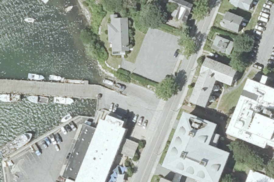
Great Harbor Landing is a public boat ramp on Eel Pond near Falmouth, Massachusetts, run by Town of Falmouth Harbormaster.
- Paved ramp
- Tidal
Status not reported No closure has been posted for this launch, but its agency does not publish open or closed status. Check with the managing agency before you tow.
At the launch
- Type
- Boat ramp
- Ramp surface
- Paved
- Tidal
- Yes
- Managed by
- Town of Falmouth Harbormaster
- Website
- falmouthmass.us
- Coordinates
- 41.52638, -70.67387
Channel depths in feet from the Army Corps' surveys (New England District; the one nearest this launch is of November 20, 2024). Not for navigation.
Conditions
- Weather forecast for this launch · National Weather Service
- Tide predictions at OCEANOGRAPHIC INSTITUTION · NOAA, 0.2 mi away
Marine advisories
Advisories in effect load here; without them, see the NWS zone forecast below.
National Weather Service marine zone ANZ233, Vineyard Sound. Zone forecast: winds, seas, warnings.
Tides
Predicted highs and lows at NOAA's OCEANOGRAPHIC INSTITUTION station, 0.2 mi from this launch, in local time above MLLW. Predictions, not observations: wind and weather move the real tide. Full predictions at NOAA.
| Mon Nov 2 | High 1:34 am 1.7 ft · Low 9:19 am 0.4 ft · High 2:10 pm 2.2 ft · Low 10:08 pm 0.0 ft |
|---|---|
| Tue Nov 3 | High 2:34 am 1.8 ft · Low 10:30 am 0.3 ft · High 3:10 pm 2.0 ft · Low 10:58 pm 0.0 ft |
| Wed Nov 4 | High 3:37 am 1.9 ft · Low 11:32 am 0.2 ft · High 4:07 pm 1.9 ft · Low 11:43 pm 0.1 ft |
| Thu Nov 5 | High 4:34 am 2.1 ft · Low 12:31 pm 0.2 ft · High 4:58 pm 1.8 ft |
| Fri Nov 6 | Low 12:26 am 0.2 ft · High 5:22 am 2.3 ft · Low 1:28 pm 0.2 ft · High 5:43 pm 1.7 ft |
| Sat Nov 7 | Low 1:06 am 0.3 ft · High 6:08 am 2.5 ft · Low 2:18 pm 0.1 ft · High 6:26 pm 1.7 ft |
| Sun Nov 8 | Low 1:35 am 0.4 ft · High 6:52 am 2.5 ft · Low 3:01 pm 0.1 ft · High 7:10 pm 1.7 ft |
Channel survey
The Army Corps surveys the channels it maintains and posts every survey.
- Woods Hole Channel · 0.4 mi from this launch
Condition survey of November 20, 2024 by the New England District. Least depth in the channel (13-Foot Strait Channel): 12.9 ft below mean lower low water (MLLW); project depth 13 ft. Survey sheet (PDF)
US Army Corps of Engineers hydrographic surveys, from eHydro. A survey shows the bottom on the day it was made; channels shoal after high water and change with dredging. Not for navigation.
On Eel Pond
Pond in Massachusetts. All launches on Eel Pond.
Nearby launches
- Salt Pond Carry-in Access near Falmouth · 2.4 mi · Salt Pond
- Salt Pond Carry-in Access near Falmouth · 2.8 mi · Salt Pond
- Siders Pond Carry-in Access · 3.4 mi · Siders Pond
- Shivericks Pond Carry-in Access · 3.6 mi · Shivericks Pond
- Falmouth Inner Harbor · 4.0 mi · Falmouth Inner Harbor
- Great Bay · 5.1 mi · Great Pond
Sources
- Massachusetts CZM Coast Guide public access sites (boat ramps) record great-harbor-landing-falmouth · Permission is granted to copy and use the materials herein (CZM, ArcGIS item 49202cb9bbde4d0ebb914fbf8015646f)
- Massachusetts Coastal Boat Ramps (Division of Marine Fisheries) record great-harbor-woods-hole-falmouth-albatross-st · Permission is granted to copy and use the materials herein (EEA and DFG, ArcGIS item f6e06b2f636a455f9037e17aaeaa448a)
- Massachusetts CZM Coast Guide boat ramp points record great-harbor-landing-falmouth · Permission is granted to copy and use the materials herein (EEA and CZM, ArcGIS item 018d6059fef841ae94a361c3b49f43f9)
- OpenStreetMap w909098226 © OpenStreetMap contributors, ODbL
- OpenStreetMap n2181965124 © OpenStreetMap contributors, ODbL
Why it is listed as public: listed by Massachusetts CZM Coast Guide public access sites (boat ramps) and Massachusetts Coastal Boat Ramps (Division of Marine Fisheries) and Massachusetts CZM Coast Guide boat ramp points. Something wrong, or is this launch private? Send a correction; it goes to a person.