
Vermont / Otter Creek /
Falls Park boat launch (Vergennes Falls Park)
Falls Park boat launch (Vergennes Falls Park) is a public boat ramp on Otter Creek near Vergennes, Vermont.
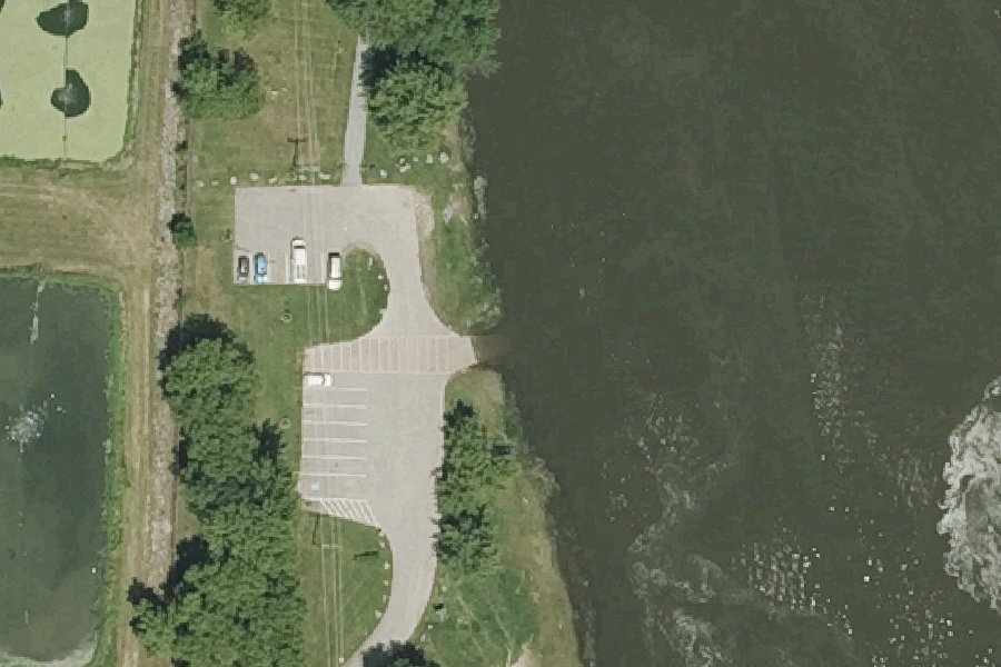
Status not reported No closure has been posted for this launch, but its agency does not publish open or closed status. Check with the managing agency before you tow.
At the launch
- Type
- Boat ramp
- Car parking
- Yes
- Coordinates
- 44.16786, -73.25794
Conditions
- Weather forecast for this launch · National Weather Service
- Water level, flow at the LITTLE OTTER CREEK AT FERRISBURG, VT gauge · USGS, 2.1 mi away on Otter Creek
Water level
Latest reading loads here; without it, see the USGS page below.
USGS gauge LITTLE OTTER CREEK AT FERRISBURG, VT, 2.1 mi from this launch on Otter Creek: water level, flow, a reading every 15 minutes. Readings and history at USGS.
On Otter Creek
Otter Creek is the longest river entirely within Vermont. It runs about 112 miles and is the main watercourse of Rutland and Addison counties. It rises on the western slopes of Mount Tabor in Peru, in the Green Mountain National Forest. From there it flows north through Danby, Wallingford, Clarendon, Rutland, Proctor, Pittsford and Brandon, then through Middlebury, Weybridge and Vergennes, and empties into Lake Champlain at Ferrisburgh. The source and mouth are only 68 miles apart, and meandering accounts for the rest of the river's length. Waterfalls along its course once powered mills, and the river still has several hydroelectric facilities. Below the falls at Vergennes, the last seven miles or so sit at lake level. The valley has wide floodplains and large wetlands, including Cornwall Swamp and the Brandon Swamp. More about Otter Creek.
Boating rules on Otter Creek
- Within 200 feet of the shoreline, vessels may not go faster than 5 mph or make a wake (statewide law, 23 V.S.A. 3311(c)). A 1989 state ruling confirmed it applies to Otter Creek between the Fort Cassin fishing access area and Lake Champlain. source
Community
Where people who use Otter Creek talk about it.
- Otter Creek Watershed - Addison County River Watch Collaborative (ACRPC) Association
- Otter Creek Natural Resources Conservation District Association
- Vermont Fishing Access Areas - Vermont Fish & Wildlife Agency
- Otter Creek Wildlife Management Area Agency
- Otter Creek at VT 22A, at Vergennes, VT - USGS water data Link
- Otter Creek: Beldens Falls to Bleeders Dam (Otter Creek gorge) - American Whitewater Link
- otter creek, vergennes vt - Paddling.com forums Forum
- Search Reddit: r/vermont Reddit
- Search all of Reddit for Otter Creek, Vermont Reddit
Nearby launches
- South Slang · 4.2 mi · Little Otter Creek
- Dead Creek Carry-in Access near Addison · 4.6 mi · Dead Creek
- Lake Champlain Boat Launch near Vergennes · 4.7 mi · Lake Champlain
- Fort Cassin · 4.7 mi · Lake Champlain
- Lake Champlain Boat Launch near Ecole Champlain · 5.2 mi · Lake Champlain
- Lewis Creek Boat Launch · 5.7 mi · Lewis Creek
Sources
- OpenStreetMap n4231991005 © OpenStreetMap contributors, ODbL
Why it is listed as public: www.vergennesrec.org: There are picnic tables, bbq grills, a boat launch, a walking trail. Something wrong, or is this launch private? Send a correction; it goes to a person.