
Florida / Caloosahatchee River /
Caloosahatchee River Boat Launch near LaBelle
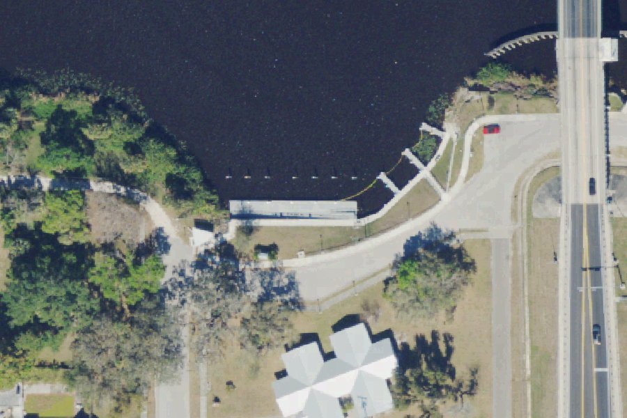
This is a free public boat ramp on the Caloosahatchee River near LaBelle, Florida.
- Free
Status not reported No closure has been posted for this launch, but its agency does not publish open or closed status. Check with the managing agency before you tow.
At the launch
- Type
- Boat ramp
- Fee
- Free
- Coordinates
- 26.76871, -81.43813
Directions (Google) Apple Maps
This launch has no official name in our sources; the name above describes where it is.
Channel depths in feet from the Army Corps' surveys (Jacksonville District; the one nearest this launch is of June 25, 2020). Not for navigation.
Boating rules
- Slow Speed Minimum Wake · zone at SR 29 Bridge, at or next to this launch rule
From the boating rules map of Florida Fish and Wildlife Conservation Commission, read October 18, 2026. A map of rules is a guide: the regulation's text and the posted signs govern.
Conditions
- Weather forecast for this launch · National Weather Service
Channel survey
The Army Corps surveys the channels it maintains and posts every survey.
- OWW Caloosahatchee Canal (East)
Condition survey of June 25, 2020 by the Jacksonville District. Soundings on the sheet down to 46.5 ft below mean lower low water (MLLW), with bars at or above it; the Corps maintains a 8 ft channel here. Survey sheet (PDF)
US Army Corps of Engineers hydrographic surveys, from eHydro. A survey shows the bottom on the day it was made; channels shoal after high water and change with dredging. Not for navigation.
On Caloosahatchee River
The Caloosahatchee River runs about 67 miles along the southwest Gulf Coast of Florida. It drains rural land on the northern edge of the Everglades. The river starts at Lake Hicpochee in southeastern Glades County and flows west-southwest past LaBelle, where it becomes tidal. It then widens as it passes Fort Myers and Cape Coral and enters the Gulf of Mexico at San Carlos Bay. Its basin covers 1,377 square miles. In 1881 Hamilton Disston had a canal dug from Lake Okeechobee to Lake Hicpochee and had the upper river straightened. Today the river, also called C-43, is a channelized flood-control and navigation waterway. The U.S. Army Corps of Engineers maintains it as part of the Okeechobee Waterway. Three locks control the river: Moore Haven (S-77), Ortona (S-78) and the Franklin Lock and Dam near Olga. The Franklin structure keeps the fresh river water apart from the saltwater estuary and marks the start of a 30-mile tidal reach. More about Caloosahatchee River.
Boating rules on Caloosahatchee River
- Slow speed all year along portions of the Caloosahatchee shoreline in the Cape Coral-North Fort Myers and Shell Point-Fort Myers areas (marked Intracoastal Waterway channel excluded) - manatee protection zone source
- Idle speed all year east of the railroad trestle at Beautiful Island; Intracoastal Waterway channel 25 mph April 1 - November 14 source
- Thompson Cutoff area: slow speed all year; Okeechobee Waterway channel slow speed November 15 - March 31 and 25 mph maximum the rest of the year source
- Idle speed all year in the Orange River south of its confluence with the Caloosahatchee; no entry November 15 - March 31 in the Tice power plant discharge canal source
Community
Where people who use Caloosahatchee River talk about it.
- Calusa Waterkeeper Association
- Calusa Waterkeeper (Facebook) Facebook
- Fishing Florida's Caloosahatchee and surrounding areas. Facebook
- Caloosahatchee River (Facebook page) Facebook
- Navigation notices - South Florida Water Management District Agency
- Search Reddit: r/florida Reddit
- Search all of Reddit for Caloosahatchee River, Florida Reddit
Nearby launches
- Labelle Recreation Access Area - Hendry County Boat Dock - Bob Mason Park · 0.2 mi · Caloosahatchee River
- Ortona Locks North Day Use Area Public Boat Ramp · 8.1 mi · Caloosahatchee Canal
- Alva Public Boat Ramp · 11.1 mi · Caloosahatchee River
- Fisheating Creek Wildlife and Environmental Area - Burnt Bridge Canoe/Kayak Launch (Accessible by Outfitter Shuttle Only) · 13.0 mi · Fisheating Creek
- Caloosahatchee Regional Park - Kayak Launch · 13.2 mi · Caloosahatchee River
- Fisheating Creek Wildlife Management Area - Day Use Area Boat Ramp/Canoe Launch · 13.7 mi · Fisheating Creek
Sources
- South Florida Water Management District Managed Land Boat Ramps record -81.43813,26.76871 · Public record of the South Florida Water Management District (Florida Statutes ch. 119), provided as is; credit the District
Why it is listed as public: listed by South Florida Water Management District Managed Land Boat Ramps. Something wrong, or is this launch private? Send a correction; it goes to a person.