
Arvon Township Park
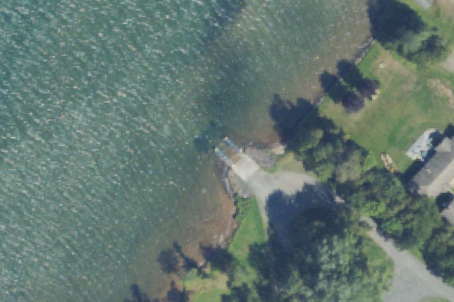
Arvon Township Park is a public boat ramp on Lake Superior near Skanee, Michigan, run by the township.
- 1 lane
- 2 docks
Status not reported No closure has been posted for this launch, but its agency does not publish open or closed status. Check with the managing agency before you tow.
At the launch
- Type
- Boat ramp
- Ramp lanes
- 1
- Docks
- 2
- Restrooms
- No
- Managed by
- Township
- Coordinates
- 46.87103, -88.23330
Conditions
- Weather forecast for this launch · National Weather Service
Marine advisories
Advisories in effect load here; without them, see the NWS zone forecast below.
National Weather Service marine zone LSZ247, Portage Lake to Huron Island MI to Lower Entrance of Portage Canal To Huron Islands MI Including Keweenaw and Huron Bays. Zone forecast: winds, seas, warnings.
On Lake Superior
Lake Superior is the northernmost, westernmost and highest of the Great Lakes. It is also the largest freshwater lake in the world by surface area, covering about 31,700 square miles. It lies on the Canada–United States border, with Ontario to the north and east, Minnesota to the west, and Michigan and Wisconsin to the south. The lake was formed by glaciers. Its average depth is 483 feet and its maximum depth is 1,333 feet. It drains into Lake Huron through the St. Marys River. Michigan settlements on the lake include Marquette and Sault Ste. Marie, and its islands include Isle Royale and Grand Island. More about Lake Superior.
Boating rules on Lake Superior
- Slow/no-wake speed within 100 feet of the shoreline, other boats, piers, people, rafts and swimming areas (Pictured Rocks National Lakeshore) source
- Personal watercraft allowed only from near Sand Point to the east end of Miners Beach, within the lakeshore's 1/4-mile offshore jurisdiction source
- Boats and motors of any size allowed on Lake Superior at Pictured Rocks source
- Isle Royale National Park: water skiing and personal watercraft banned; no pets, including on boats source
- Isle Royale National Park: permit needed for boaters staying overnight at anchor, at docks or in campgrounds; quiet/no-wake zones apply source
- Michigan law: remove aquatic plants before launching; before moving a boat over land, pull drain plugs, drain live wells and bilges, and remove organisms (fines up to $100) source
Community
Where people who use Lake Superior talk about it.
- Superior Watershed Partnership & Land Conservancy Association
- Lake Superior Buoys and Webcams – Superior Watershed Partnership Link
- Kayaking & Boating - Pictured Rocks National Lakeshore Agency
- Private Boating - Isle Royale National Park Agency
- Lake Superior Fishing Reports - Salmon and Trout - Great Lakes Fisherman Forum
- Joe's Lake Superior Fishing Reports (Marquette) Forum
- Search Reddit: r/Michigan Reddit
- Search all of Reddit for Lake Superior, Michigan Reddit
Nearby launches
- Roland Lake Boat Launch · 4.0 mi · Roland Lake
- Silver River Boat Launch · 4.7 mi · Silver River
- Big Eric's Bridge SFCG · 7.1 mi · Huron River
- Silver Falls · 7.3 mi · Silver River
- White City · 12.1 mi · Portage River
- South Portage Entry Boat Launch · 12.6 mi · Portage River
Sources
- Michigan DNR Boat Launches (DNR inventory layer) record A-07-019 · Public record of the State of Michigan; no restrictions on use stated
- Great Lakes Commission Boat Access Sites (compilation, public and private) record -88.21871,46.87991 · CC BY 4.0 (Great Lakes Commission compilation); coverage and attribute completeness vary by jurisdiction
Why it is listed as public: listed by Michigan DNR Boat Launches (DNR inventory layer) and Great Lakes Commission Boat Access Sites (compilation, public and private). Something wrong, or is this launch private? Send a correction; it goes to a person.