
Florida / Kayak trail /
Tarpon Bay Explorers
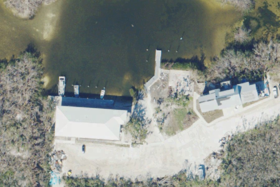
Tarpon Bay Explorers is a public kayak and canoe launch on Kayak trail near Sanibel, Florida, run by Sanibel Captiva Conservation Foundation.
- $10
- 1 lane
- 5 trailer spaces
- Restrooms
- Tidal
Open per Florida Boat Ramp Inventory (FWC)'s data, checked October 15, 2026. Seasonal gates, low water and storms are not always posted; check before you tow.
At the launch
- Type
- Carry-in (canoe and kayak)
- Fee
- $10
- Ramp lanes
- 1
- Ramp surface
- Concrete ramp or sand beach
- Trailer parking
- 5 spaces
- Car parking
- 25 spaces
- Restrooms
- Flush toilet
- Hours
- 8:00 AM to 4:00 PM daily
- Tidal
- Yes
- Managed by
- Sanibel Captiva Conservation Foundation
- Website
- tarponbayexplorers.com
- Coordinates
- 26.44239, -82.08291
Boating rules
- Manatee zone: Slow Speed (All Year) · a zone at or next to this launch rule
From the boating rules map of Florida Fish and Wildlife Conservation Commission, read October 18, 2026. A map of rules is a guide: the regulation's text and the posted signs govern.
Conditions
- Weather forecast for this launch · National Weather Service
- Tide predictions at Tarpon Bay, Sanibel Island · NOAA, 0.1 mi away
Marine advisories
Advisories in effect load here; without them, see the NWS zone forecast below.
National Weather Service marine zone GMZ836, Charlotte Harbor and Pine Island Sound. Zone forecast: winds, seas, warnings.
Tides
Predicted highs and lows at NOAA's Tarpon Bay, Sanibel Island station, 0.1 mi from this launch, in local time above MLLW. Predictions, not observations: wind and weather move the real tide. Full predictions at NOAA.
| Mon Nov 2 | Low 12:50 am 1.5 ft · High 6:30 am 2.3 ft · Low 2:27 pm 0.4 ft · High 8:44 pm 1.9 ft |
|---|---|
| Tue Nov 3 | Low 2:27 am 1.2 ft · High 8:10 am 2.2 ft · Low 3:14 pm 0.6 ft · High 9:22 pm 2.1 ft |
| Wed Nov 4 | Low 3:32 am 0.9 ft · High 9:27 am 2.2 ft · Low 3:56 pm 0.7 ft · High 9:59 pm 2.3 ft |
| Thu Nov 5 | Low 4:31 am 0.6 ft · High 10:39 am 2.2 ft · Low 4:35 pm 0.9 ft · High 10:34 pm 2.4 ft |
| Fri Nov 6 | Low 5:24 am 0.3 ft · High 11:34 am 2.2 ft · Low 5:12 pm 1.0 ft · High 11:06 pm 2.6 ft |
| Sat Nov 7 | Low 6:12 am 0.0 ft · High 12:18 pm 2.1 ft · Low 5:46 pm 1.2 ft · High 11:33 pm 2.6 ft |
| Sun Nov 8 | Low 6:58 am -0.1 ft · High 12:59 pm 2.1 ft · Low 6:16 pm 1.3 ft · High 11:57 pm 2.7 ft |
On Kayak trail
Stream in Florida. All launches on Kayak trail.
Nearby launches
- J.N. Ding Darling National Wildlife Refuge - Wildlife Drive Kayak Site East · 2.0 mi · San Carlos Bay
- Sanibel Bock Peace Park Kayak Access (Resident Parking Only) · 2.4 mi · San Carlos Bay
- Sanibel Bayview Park Kayak Access (Resident Parking Only) · 2.9 mi · San Carlos Bay
- Sanibel Island Public Boat Ramp · 3.0 mi · San Carlos Bay
- Sanibel Causeway Islands Park - Island B Paddlecraft Access · 3.7 mi · San Carlos Bay
- J.N. Ding Darling National Wildlife Refuge - Wildlife Drive Kayak Site West · 4.1 mi · Hardworking Bayou
Sources
- Florida Boat Ramp Inventory (FWC) record LE05082IE · Open data; credit to FWC-FWRI requested
- US Fish and Wildlife Service facility property (boat launches) record 29d515d4-f1e4-4453-88cd-b6d441014d8c · US federal government data, public domain (FWS no-liability disclaimer)
- U.S. Fish and Wildlife Service boat ramps (FHWA Federal Lands Transportation Facility Inventory) record -82.08290,26.44238 · US federal government data, public domain (FHWA Federal Lands Transportation Facility Inventory, U.S. Fish and Wildlife Service submittal)
Why it is listed as public: tarponbayexplorers.com: Non-motorized Launches are $7+tax, motorized launches are $20+tax.. Something wrong, or is this launch private? Send a correction; it goes to a person.