
Connecticut / Housatonic River /
Sunnyside Boat Ramp
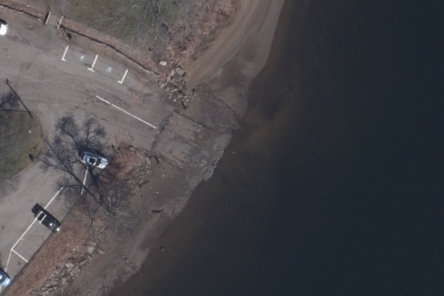
Sunnyside Boat Ramp is a boat ramp open to residents or permit holders on the Housatonic River near Shelton, Connecticut, run by City of Shelton.
- Residents or permit only
- Fee charged
- Accessible
- Tidal
Public, but limited to residents, sticker or permit holders (on tribal land, a tribal permit). Check the rules with the town, tribe or agency before you go.
Status not reported No closure has been posted for this launch, but its agency does not publish open or closed status. Check with the managing agency before you tow.
At the launch
- Type
- Boat ramp
- Fee
- Fee charged
- Restrooms
- No
- Tidal
- Yes
- Wheelchair access
- Yes
- Managed by
- City of Shelton
- Website
- sheltonparksandrec.org
- Coordinates
- 41.29017, -73.06921
Conditions
- Weather forecast for this launch · National Weather Service
- Tide predictions at Shelton · NOAA, 0.8 mi away
Tides
Predicted highs and lows at NOAA's Shelton station, 0.8 mi from this launch, in local time above MLLW. Predictions, not observations: wind and weather move the real tide. Full predictions at NOAA.
| Mon Nov 2 | Low 12:05 am 0.5 ft · High 5:38 am 6.8 ft · Low 12:28 pm 0.8 ft · High 6:03 pm 7.1 ft |
|---|---|
| Tue Nov 3 | Low 1:08 am 0.5 ft · High 6:44 am 7.0 ft · Low 1:36 pm 0.7 ft · High 7:10 pm 7.0 ft |
| Wed Nov 4 | Low 2:08 am 0.4 ft · High 7:46 am 7.3 ft · Low 2:39 pm 0.5 ft · High 8:12 pm 7.0 ft |
| Thu Nov 5 | Low 3:02 am 0.3 ft · High 8:42 am 7.6 ft · Low 3:37 pm 0.3 ft · High 9:08 pm 7.1 ft |
| Fri Nov 6 | Low 3:52 am 0.3 ft · High 9:31 am 7.9 ft · Low 4:28 pm 0.0 ft · High 9:57 pm 7.1 ft |
| Sat Nov 7 | Low 4:38 am 0.3 ft · High 10:15 am 8.0 ft · Low 5:14 pm -0.1 ft · High 10:42 pm 7.1 ft |
| Sun Nov 8 | Low 5:20 am 0.4 ft · High 10:55 am 8.0 ft · Low 5:56 pm -0.1 ft · High 11:24 pm 7.0 ft |
On the river
Keep well clear of dams: strong currents and restricted zones above and below them.
- Dam, 3.4 mi upstream: Lake Housatonic Dam. · Connecticut DEEP dams (public use)
- Dam, 9.3 mi upstream: Stevenson Dam. · Connecticut DEEP dams (public use)
Up to 10 river miles each way, from the agencies' inventories; not every hazard is listed and rivers change. Scout before you go.
Sources: Connecticut DEEP dams (public use).
On Housatonic River
The Housatonic River is a river about 149 miles long in western Massachusetts and western Connecticut. It begins where its West and East branches meet in Pittsfield, Massachusetts, drains about 1,950 square miles and empties into Long Island Sound between Stratford and Milford. Five hydroelectric dams hold back the river in Connecticut: Falls Village, Bulls Bridge, Shepaug, Stevenson and Derby. The last three form a chain of lakes running from New Milford south to Shelton: Lake Lillinonah, Lake Zoar and Lake Housatonic. Below Derby Dam the river is tidal for its whole length, and its lower end is brackish to salty. In December 2022 the 41-mile stretch from the Massachusetts line to the Boardman Bridge in New Milford was designated a National Wild and Scenic River. More about Housatonic River.
Boating rules on Housatonic River
- Slow no wake when passing marinas, yacht clubs, fuel docks, anchorages, docks, boat launches and congested areas source
- Slow no wake in the channel east of Nells Island and in all channels, creeks and waterways within the Charles E. Wheeler Wildlife Management Area source
- Slow no wake from the Devon railroad bridge (Milford–Stratford) south to navigation aid #14 source
- Slow no wake from the northernmost to the southernmost tip of Wooster Island source
- Slow no wake from 500 feet upstream of navigation aid #4 to 500 feet downstream of navigation aid #3 source
- Fly-fishing only in the lower three miles of the Housatonic River Trout Management Area (Cornwall) source
- Catch-and-release only for trout and smallmouth bass, all year, in the Bulls Bridge Trout and Bass Management Area source
Community
Where people who use Housatonic River talk about it.
- Housatonic Valley Association Association
- Housatonic Valley Association (Facebook) Facebook
- Housatonic River Commission Association
- Housatonic River Estuary Commission (City of Milford code) Agency
- Housatonic River - CT DEEP Fishing Agency
- Housatonic Fly Fishermen's Association Club
- Housatonic Fly Fishing Association (Facebook) Facebook
- CTFishTalk.com: Housatonic River - Sunnyside (River Reports) Forum
- Search Reddit: r/Connecticut Reddit
- Search all of Reddit for Housatonic River, Connecticut Reddit
Nearby launches
- Witek Memorial Park · 2.3 mi · Upper Ansonia Reservoir
- Lake Housatonic Boat Launch · 4.5 mi · Lake Housatonic
- Milford Municipal Boat Launch · 4.9 mi · Milford Harbor
- Caswell Cove Water Access Area · 5.1 mi · Housatonic River
- Silver Sands State Park · 5.9 mi · Long Island Sound
- South Street Beach · 6.2 mi · Long Island Sound
Sources
- Connecticut DEEP Coastal Access Sites (boat launches and car-top access) record 311 · No access or use limitations (layer metadata, ArcGIS item d8eb7731d7d84a149917809241f970ec)
Why it is listed as public: listed by Connecticut DEEP Coastal Access Sites (boat launches and car-top access). Something wrong, or is this launch private? Send a correction; it goes to a person.