
Stovers Cove Boat Launch
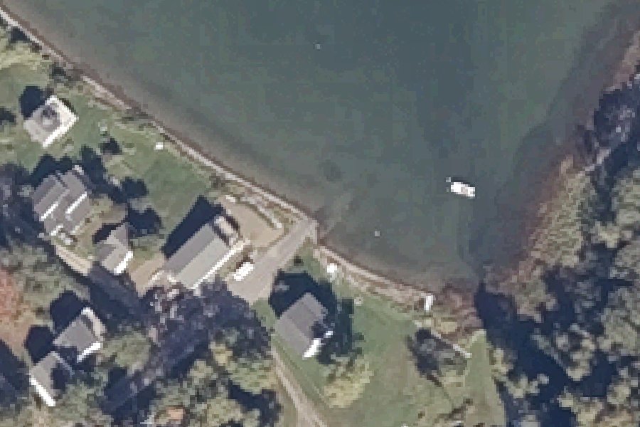
Stovers Cove Boat Launch is a public boat ramp on Casco Bay near Bailey Island, Maine.
- Tidal
Status not reported No closure has been posted for this launch, but its agency does not publish open or closed status. Check with the managing agency before you tow.
At the launch
- Type
- Boat ramp
- Tidal
- Yes
- Website
- harpswell.maine.gov
- Coordinates
- 43.75472, -70.00641
Conditions
- Weather forecast for this launch · National Weather Service
- Tide predictions at South Harpswell, Potts Harbor · NOAA, 1.4 mi away
Marine advisories
Advisories in effect load here; without them, see the NWS zone forecast below.
National Weather Service marine zone ANZ153, Casco Bay. Zone forecast: winds, seas, warnings.
Tides
Predicted highs and lows at NOAA's South Harpswell, Potts Harbor station, 1.4 mi from this launch, in local time above MLLW. Predictions, not observations: wind and weather move the real tide. Full predictions at NOAA.
| Mon Nov 2 | High 4:42 am 8.6 ft · Low 10:37 am 1.1 ft · High 4:58 pm 9.5 ft · Low 11:24 pm 0.2 ft |
|---|---|
| Tue Nov 3 | High 5:48 am 8.8 ft · Low 11:48 am 1.0 ft · High 6:07 pm 9.3 ft |
| Wed Nov 4 | Low 12:29 am 0.3 ft · High 6:51 am 9.1 ft · Low 12:58 pm 0.8 ft · High 7:14 pm 9.2 ft |
| Thu Nov 5 | Low 1:28 am 0.3 ft · High 7:47 am 9.4 ft · Low 1:59 pm 0.4 ft · High 8:13 pm 9.3 ft |
| Fri Nov 6 | Low 2:21 am 0.3 ft · High 8:37 am 9.7 ft · Low 2:53 pm 0.0 ft · High 9:06 pm 9.2 ft |
| Sat Nov 7 | Low 3:08 am 0.4 ft · High 9:23 am 9.9 ft · Low 3:41 pm -0.2 ft · High 9:54 pm 9.2 ft |
| Sun Nov 8 | Low 3:51 am 0.5 ft · High 10:04 am 10.0 ft · Low 4:25 pm -0.3 ft · High 10:39 pm 9.1 ft |
On Casco Bay
Casco Bay is an open bay of the Gulf of Maine on the southern Maine coast. NOAA's chart puts its seaward boundary on a line from Bald Head on Cape Small in Phippsburg to Dyer Point in Cape Elizabeth. The bay covers about 229 square miles, roughly 146,600 acres. One estimate puts its shoreline at 578 miles. The Harpswell Neck peninsula splits the inner bay into eastern and western sections. Its deepest point, southwest of Halfway Rock, is about 204 feet, and the tidal range averages about nine feet. Portland lies on the western edge. Brunswick, Falmouth, Freeport, Harpswell and the island towns of Chebeague Island and Long Island also front the bay. Its 985-square-mile watershed drains through the Presumpscot, Royal and Stroudwater rivers. The Casco Bay Estuary Partnership estimates 785 islands, islets and exposed ledges, known as the Calendar Islands. More about Casco Bay.
Boating rules on Casco Bay
- No Discharge Area: releasing raw or treated sewage (blackwater) from any vessel is illegal; boats must hold it until pumped out source
- Fee charged at Portland's Eastern Promenade/East End boat ramps (attendant on site) source
- Ramp-use fee for non-residents at the Falmouth Town Landing source
- Simpson's Point Landing (Brunswick) takes carry-in canoes and kayaks only source
Community
Where people who use Casco Bay talk about it.
Nearby launches
- Garrison Cove Boat Launch · 0.9 mi · Casco Bay
- Town Landing · 1.0 mi · Casco Bay
- Graveyard Point Town Landing · 1.1 mi · Casco Bay
- Mitchell Field · 1.1 mi · Curtis Cove
- Tide Mill Landing · 1.4 mi · Casco Bay
- Pott's Point Town Landing · 1.5 mi · Casco Bay
Sources
- OpenStreetMap n7179449188 © OpenStreetMap contributors, ODbL
Why it is listed as public: www.harpswell.maine.gov: Located on Harpswell Harbor, this well-paved, low angle boat launch is a great way to access the harbor during high tide.. Something wrong, or is this launch private? Send a correction; it goes to a person.