
Florida / Halifax River /
Ross Point Park
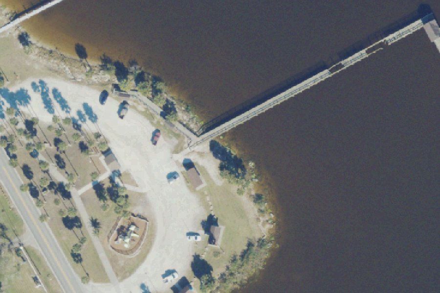
Ross Point Park is a public kayak and canoe launch on the Halifax River near Holly Hill, Florida.
- Restrooms
Status not reported No closure has been posted for this launch, but its agency does not publish open or closed status. Check with the managing agency before you tow.
At the launch
- Type
- Carry-in (canoe and kayak)
- Restrooms
- Yes
- Coordinates
- 29.23820, -81.03150
Channel depths in feet from the Army Corps' surveys (Jacksonville District; the one nearest this launch is of March 25, 2022). Not for navigation.
Boating rules
- Manatee zone: Slow Speed (All Year) · a zone at or next to this launch rule
- Manatee zone: Max 30 MPH/25 MPH Night (All Year) Includes main marked channel of Atl ICW · a zone at or next to this launch rule
From the boating rules map of Florida Fish and Wildlife Conservation Commission, read October 18, 2026. A map of rules is a guide: the regulation's text and the posted signs govern.
Conditions
- Weather forecast for this launch · National Weather Service
Marine advisories
Advisories in effect load here; without them, see the NWS zone forecast below.
National Weather Service marine zone AMZ550, Flagler Beach to Volusia-Brevard County Line 0-20 nm. Zone forecast: winds, seas, warnings.
Channel survey
The Army Corps surveys the channels it maintains and posts every survey.
- IWW JAX to MIA (Volusia County) · 0.2 mi from this launch
Condition survey of March 25, 2022 by the Jacksonville District. Least depth in the channel: 6.8 ft below mean lower low water (MLLW); project depth 12 ft. Survey sheet (PDF)
US Army Corps of Engineers hydrographic surveys, from eHydro. A survey shows the bottom on the day it was made; channels shoal after high water and change with dredging. Not for navigation.
On Halifax River
The Halifax River is a tidal waterway in northeast Volusia County, Florida, and forms part of the Atlantic Intracoastal Waterway. It begins at Tomoka Bay, next to Tomoka State Park, where the Tomoka River, Bulow Creek and Halifax Creek meet. From there it flows south for about 25 miles past Ormond Beach, Holly Hill, Daytona Beach, South Daytona and Port Orange. Near its southern end it joins Spruce Creek and the Mosquito Lagoon, then reaches the Atlantic Ocean through Ponce de Leon Inlet. Its drainage basin covers most of eastern Volusia County. The waterway was first called the North Mosquito River. It was renamed for George Montagu-Dunk, 2nd Earl of Halifax, during the British occupation of Florida (1763-1784). Six bridges cross it, from the Granada Bridge in Ormond Beach south to the Port Orange Causeway. More about Halifax River.
Boating rules on Halifax River
- State manatee protection speed zones on the Intracoastal Waterway in Volusia County (Rule 68C-22.012, F.A.C.): idle speed, slow speed, 25/30/35 mph, seasonal, shoreline buffer and nighttime zones source
- Manatee protection areas under FAC Chapter 68C-22 apply in Volusia County; the county links an interactive zone map source
- Tomoka River Manatee Sanctuary (City of Ormond Beach): slow/idle speed zones; personal watercraft and airboats prohibited source
Community
Where people who use Halifax River talk about it.
Nearby launches
- Holly Hill Sunrise Park · 0.7 mi · Halifax River
- Seabreeze Park And Boat Ramp · 0.8 mi · Halifax River
- Downtown Daytona Beach Park · 2.1 mi · Halifax River
- City Island Recreation Hall Boat Ramp (Small Boats - Limited Parking) · 2.2 mi · Halifax River
- Halifax Harbor Marina · 2.5 mi · Halifax River
- Ormond Beach Central Park - Fleming Avenue Kayak Launch Dock · 2.9 mi · Central Park Fleming Pond
Sources
- Florida DEP Circumnavigational Saltwater Paddling Trail kayak launches record -81.03150,29.23820 · FDEP: relative location reference only, not a survey; credit FDEP Office of Greenways and Trails and the Florida Paddling Trail Association
Why it is listed as public: listed by Florida DEP Circumnavigational Saltwater Paddling Trail kayak launches. Something wrong, or is this launch private? Send a correction; it goes to a person.