
Florida / Biscayne Bay /
Oleta River State Park Canoe/Kayak Launch
Oleta River State Park Canoe/Kayak Launch is a public kayak and canoe launch on Biscayne Bay near Surfside, Florida, run by Florida State Parks.
- Tidal
Status not reported No closure has been posted for this launch, but its agency does not publish open or closed status. Check with the managing agency before you tow.
At the launch
- Type
- Carry-in (canoe and kayak)
- Tidal
- Yes
- Managed by
- Florida State Parks
- Coordinates
- 25.90779, -80.13680
Channel depths in feet from the Army Corps' surveys (Jacksonville District; the one nearest this launch is of July 8, 2019). Not for navigation.
Boating rules
- Manatee zone: Slow Speed (All Year) · a zone at or next to this launch rule
From the boating rules map of Florida Fish and Wildlife Conservation Commission, read October 18, 2026. A map of rules is a guide: the regulation's text and the posted signs govern.
Conditions
- Weather forecast for this launch · National Weather Service
- Tide predictions at Bakers Haulover Inlet (inside) · NOAA, 0.8 mi away
Marine advisories
Advisories in effect load here; without them, see the NWS zone forecast below.
National Weather Service marine zone AMZ630, Biscayne Bay. Zone forecast: winds, seas, warnings.
Tides
Predicted highs and lows at NOAA's Bakers Haulover Inlet (inside) station, 0.8 mi from this launch, in local time above MLLW. Predictions, not observations: wind and weather move the real tide. Full predictions at NOAA.
| Mon Nov 2 | High 3:05 am 2.4 ft · Low 9:47 am 0.5 ft · High 3:47 pm 2.4 ft · Low 10:26 pm 0.6 ft |
|---|---|
| Tue Nov 3 | High 4:16 am 2.4 ft · Low 10:54 am 0.5 ft · High 4:48 pm 2.5 ft · Low 11:27 pm 0.5 ft |
| Wed Nov 4 | High 5:21 am 2.5 ft · Low 11:55 am 0.5 ft · High 5:44 pm 2.5 ft |
| Thu Nov 5 | Low 12:21 am 0.4 ft · High 6:20 am 2.6 ft · Low 12:48 pm 0.5 ft · High 6:34 pm 2.5 ft |
| Fri Nov 6 | Low 1:09 am 0.3 ft · High 7:11 am 2.6 ft · Low 1:37 pm 0.5 ft · High 7:20 pm 2.5 ft |
| Sat Nov 7 | Low 1:53 am 0.2 ft · High 7:57 am 2.7 ft · Low 2:21 pm 0.5 ft · High 8:02 pm 2.5 ft |
| Sun Nov 8 | Low 2:34 am 0.1 ft · High 8:39 am 2.7 ft · Low 3:02 pm 0.5 ft · High 8:42 pm 2.5 ft |
Channel survey
The Army Corps surveys the channels it maintains and posts every survey.
- Bakers Haulover Inlet · 0.2 mi from this launch
Condition survey of July 8, 2019 by the Jacksonville District. Soundings on the sheet down to 27.9 ft below mean lower low water (MLLW), with bars at or above it; the Corps maintains a 8 ft channel here. Survey sheet (PDF)
US Army Corps of Engineers hydrographic surveys, from eHydro. A survey shows the bottom on the day it was made; channels shoal after high water and change with dredging. Not for navigation.
On Biscayne Bay
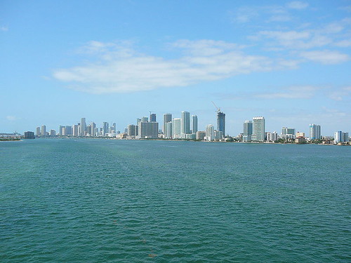
Biscayne Bay is a lagoon on the Atlantic coast of South Florida that also has the characteristics of an estuary. The part traditionally called Biscayne Bay is about 35 miles long and up to 8 miles wide, with a surface area of about 221 square miles. Broader definitions also take in Dumfoundling Bay, Card Sound and Barnes Sound, which makes the bay about 60 miles long and about 271 square miles in area. The bay averages about 5.9 feet deep and reaches about 13 feet at most, except in dredged channels. Dense development of the Miami metropolitan area surrounds the northern end. The southern end is largely undeveloped, and much of it lies within Biscayne National Park. Sixteen waterways flow into the western side, and the Miami River is the largest. The Oleta River, Arch Creek and the Little River also feed the northern bay. More about Biscayne Bay.
Boating rules on Biscayne Bay
- State manatee protection zones in Miami-Dade County (adopted 1991) limit vessel speed and in some areas limit or prohibit entry source
- Slow-speed and idle-speed/no-wake zones in Biscayne National Park waters source
- Seagrass is protected in the aquatic preserve; damaging it can bring a fine of up to $1,000 (boaters are asked to avoid shallows and raise motors over seagrass) source
- Stay 300 feet from a divers-down flag or slow down source
Community
Where people who use Biscayne Bay talk about it.
- Friends of Biscayne Bay - Non-profit Citizen Support Organization Association
- Miami Waterkeeper Association
- Friends of Biscayne Bay (Facebook) Facebook
- Biscayne Bay Aquatic Preserve (Florida DEP) Agency
- Slow Speed Zones - Biscayne National Park Agency
- Search Reddit: r/florida Reddit
- Search all of Reddit for Biscayne Bay, Florida Reddit
Nearby launches
- Oleta River State Park - Angle Fish Pavillion Paddlecraft Beach · 0.2 mi · Biscayne Bay
- Oleta River State Park - Seagrape Pavilion Paddlecraft Access · 0.3 mi · Biscayne Bay
- Oleta River State Park - Parking Lot 6 Paddlecraft Access · 0.4 mi · Biscayne Bay
- Oleta River State Park - Outdoor Center Paddlecraft Rentals and Launch · 0.6 mi · Biscayne Bay
- Bill Bird Marina - Haulover Marine Center Public Boat Ramp · 1.1 mi · Biscayne Bay
- Oleta River State Park Canoe/Kayak Launch · 1.4 mi · Oleta River
Sources
- Florida State Parks points of interest (boat ramps and canoe/kayak launches) record -80.13680,25.90779 · FDEP: relative location reference only, not a survey; acknowledge the originator (Florida DEP Division of Recreation and Parks)
Why it is listed as public: listed by Florida State Parks points of interest (boat ramps and canoe/kayak launches). Something wrong, or is this launch private? Send a correction; it goes to a person.