
Florida / North Fork Saint Lucie River /
North Fork Saint Lucie River Carry-in Access
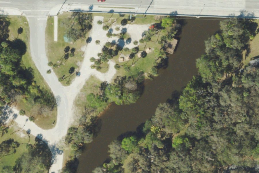
This is a free public kayak and canoe launch on the North Fork Saint Lucie River near White City, Florida.
- Free
Status not reported No closure has been posted for this launch, but its agency does not publish open or closed status. Check with the managing agency before you tow.
At the launch
- Type
- Carry-in (canoe and kayak)
- Fee
- Free
- Coordinates
- 27.37388, -80.34290
Directions (Google) Apple Maps
This launch has no official name in our sources; the name above describes where it is.
Boating rules
- Manatee zone: Max 25 MPH (All Year) · a zone at or next to this launch rule
From the boating rules map of Florida Fish and Wildlife Conservation Commission, read October 18, 2026. A map of rules is a guide: the regulation's text and the posted signs govern.
Conditions
- Weather forecast for this launch · National Weather Service
- Water level, water temperature at the ST LUCIE RIVER AT SPEEDY POINT, STUART FL gauge · USGS, 12.8 mi away on North Fork Saint Lucie River
Water level
Latest reading loads here; without it, see the USGS page below.
USGS gauge ST LUCIE RIVER AT SPEEDY POINT, STUART FL, 12.8 mi from this launch on North Fork Saint Lucie River: water level, water temperature, a reading every 15 minutes. Readings and history at USGS.
On North Fork Saint Lucie River
The North Fork of the St. Lucie River is a tidal river in southeastern Florida. It rises in farmland in St. Lucie County near Interstate 95, at an elevation of about 20 feet, and flows south through White City and Port Saint Lucie into Martin County. There it joins the South Fork to form the St. Lucie River estuary. The North Fork is brackish along most of its length, but north of White City it is more like a freshwater creek. The C-24 and C-23 drainage canals connect to the river system. In 1972 the state designated a 16-mile portion of the North Fork as the North Fork, St. Lucie Aquatic Preserve. The preserve covers 2,972 acres in St. Lucie and Martin counties and is also listed as an Outstanding Florida Water. More about North Fork Saint Lucie River.
Boating rules on North Fork Saint Lucie River
Community
Where people who use North Fork Saint Lucie River talk about it.
- North Fork, St. Lucie Aquatic Preserve (Florida DEP) Agency
- North Fork St. Lucie River - Oxbow Eco-Center (South Florida Water Management District) Agency
- Friends of the Spoil Islands (support group for the Indian River Lagoon aquatic preserves, including North Fork) Association
- Search Reddit: r/florida Reddit
- Search all of Reddit for North Fork Saint Lucie River, Florida Reddit
Nearby launches
- White City Park and Public Boat Ramp · 0.2 mi · North Fork Saint Lucie River
- River Place Park - Canoe Launch · 1.9 mi · North Fork Saint Lucie River
- Savannas Preserve State Park Recreation Area Canoe Launch · 2.3 mi · Savannas March and Lake
- Richard E. Becker Preserve Canoe Launch · 2.5 mi · Ten Mile Creek
- George Lestrange Preserve Canoe Launch · 2.7 mi
- Indian Hills Recreation Area Canoe Launch Dock · 3.4 mi
Sources
- South Florida Water Management District Managed Land Boat Ramps record -80.34290,27.37388 · Public record of the South Florida Water Management District (Florida Statutes ch. 119), provided as is; credit the District
Why it is listed as public: listed by South Florida Water Management District Managed Land Boat Ramps. Something wrong, or is this launch private? Send a correction; it goes to a person.