Mystic River Boat Launch
Carry-in (canoe and kayak) · on Mystic River · near Groton · Connecticut
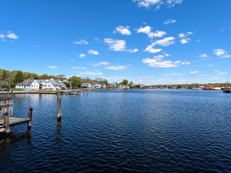
Open per Connecticut DEEP state boat launches (car-top and carry-in)'s data, updated weekly. Seasonal gates, low water and storms are not always posted; check before you tow.
At the launch
- Type
- Carry-in (canoe and kayak)
- Fee
- Free
- Ramp surface
- Dirt
- Car parking
- 8 spaces
- Restrooms
- No
- Season
- Year round
- Rules at the launch
- No vessel, propelled by power, shall move at greater than 6 mph limit when approaching or passing, and while within two hundred feet of any wharf on either side of Mystic River between its mouth and Noank beacon and the most northerly channel buoy north of the Marine Historical Association.
- Dock
- None
- Parking surface
- Dirt
- Access road
- Dirt
- Address
- 600 River Road, Groton
- Directions
- I-95, exit 89. Go south on Allyn Street, then take your first left onto Sandy Hollow Road. At the end, turn left onto High Street. Take next right onto Bindloss Road and at the end turn left onto River Road. Launch is on the right on the west bank of the Mystic River, just north of I-95.
- Wheelchair access
- No
- Managed by
- Connecticut DEEP
- Website
- portal.ct.gov
- Site sketch
- PDF from the agency
- Coordinates
- 41.37409, -71.96588
On Mystic River
River in Connecticut. All launches on Mystic River.
Community
Where people who use Mystic River talk about it.
Nearby launches
- Bluff Point Boat Launch · 4.4 mi · Poquonock River
- Barn Island Boat Launch · 5.3 mi · Wequetequock Cove
- Long Pond Boat Launch · 5.4 mi · Long Pond
- Lantern Hill Boat Launch · 5.9 mi · Lantern Hill Pond
- Bayberry Lane Boat Launch · 6.0 mi · Baker Cove
- KE Streeter Boat Launch (Thames River) · 6.2 mi · Thames River
Sources
- Connecticut DEEP state boat launches (car-top and carry-in) record 355 · Public record, no license stated (CT DEEP open data)
- Mystic River Boat Launch details read October 14, 2026
Why it is listed as public: listed by Connecticut DEEP state boat launches (car-top and carry-in). Something wrong, or is this launch private? Corrections help everyone; a reporting form is coming soon.