
Evart Riverside
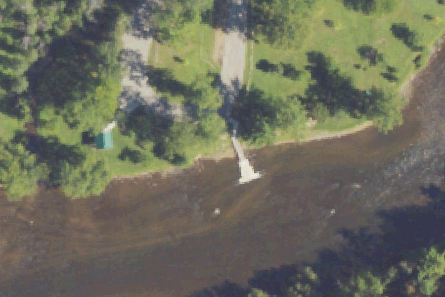
Evart Riverside is a public boat ramp on the Muskegon River near Evart, Michigan, run by the city.
- 1 lane
- 10 trailer spaces
- Restrooms
Status not reported No closure has been posted for this launch, but its agency does not publish open or closed status. Check with the managing agency before you tow.
At the launch
- Type
- Boat ramp
- Ramp lanes
- 1
- Trailer parking
- 10 spaces
- Car parking
- 10 spaces
- Restrooms
- Yes
- Managed by
- City
- Coordinates
- 43.89567, -85.25748
Conditions
- Weather forecast for this launch · National Weather Service
- Water level, flow at the MUSKEGON RIVER AT EVART, MI gauge · USGS, 0.2 mi away on Muskegon River
Water level
Latest reading loads here; without it, see the USGS page below.
USGS gauge MUSKEGON RIVER AT EVART, MI, 0.2 mi from this launch on Muskegon River: water level, flow, a reading every 15 minutes. Readings and history at USGS.
On Muskegon River
The Muskegon River is a river in Michigan's Lower Peninsula, 216 miles long. It starts at Houghton Lake in Roscommon County and flows generally southwest to Muskegon Lake at the city of Muskegon, and from there to Lake Michigan. Along the way it passes Evart, Big Rapids, Croton and Newaygo. Its watershed drains about 2,350 square miles, and its tributaries include the Little Muskegon, Hersey and Clam rivers. Grand Valley State University's Annis Water Resources Institute gives larger figures: about 219 miles of river and more than 2,700 square miles of watershed, second in Michigan only to the Grand River. Three dams owned by Consumers Energy create reservoirs on the river. They are Rogers Dam south of Big Rapids, and Hardy Dam and Croton Dam in Newaygo County. Croton Dam was built in 1907 and holds back a 1,209-acre pond. Hardy Dam was completed in 1931 and forms a 4,000-acre reservoir. More about Muskegon River.
Community
Where people who use Muskegon River talk about it.
- Muskegon River Watershed Assembly (MRWA) Association
- Muskegon River Watershed Assembly (Facebook page) Facebook
- Muskegon River Fly Fishing Facebook
- Muskegon river croton dam - Michigan Sportsman Forum Forum
- Muskegon River at Newaygo, MI - USGS Water Data Link
- Search Reddit: r/Michigan Reddit
- Search all of Reddit for Muskegon River, Michigan Reddit
Nearby launches
- Big Lake Boat Launch · 3.9 mi · Big Lake
- Crawford Park · 6.4 mi · Muskegon River
- Merrill-Gorrel County Park Boat Launch (Merrill Lake) · 8.0 mi · Merrill Lake
- Merrill-Gorrel County Park Boat Launch (Gorrel Lake) · 8.2 mi · Gorrel Lake
- Mud Lake SFCG · 8.9 mi · Big Mud Lake
- Hicks Lake Boat Launch · 9.0 mi · Hicks Lake
Sources
- Michigan DNR Boat Launches (DNR inventory layer) record A-67-019 · Public record of the State of Michigan; no restrictions on use stated
- Great Lakes Commission Boat Access Sites (compilation, public and private) record -85.25751,43.89571 · CC BY 4.0 (Great Lakes Commission compilation); coverage and attribute completeness vary by jurisdiction
- OpenStreetMap n4541976473 © OpenStreetMap contributors, ODbL
Why it is listed as public: listed by Michigan DNR Boat Launches (DNR inventory layer) and Great Lakes Commission Boat Access Sites (compilation, public and private). Something wrong, or is this launch private? Send a correction; it goes to a person.