
Michigan / Mullett Lake /
Fred M. Socha Park
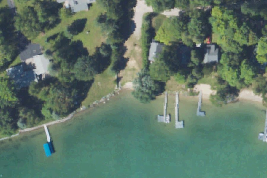
Fred M. Socha Park is a free public kayak and canoe launch on Mullett Lake near Cheboygan, Michigan.
- Free
Status not reported No closure has been posted for this launch, but its agency does not publish open or closed status. Check with the managing agency before you tow.
At the launch
- Type
- Carry-in (canoe and kayak)
- Fee
- Free
- Ramp surface
- ground
- Coordinates
- 45.57733, -84.49387
Depth contours in feet from Michigan DNR. Not for navigation.
Channel depths in feet from the Army Corps' surveys (Detroit District; the one nearest this launch is of August 19, 2026). Not for navigation.
Conditions
- Weather forecast for this launch · National Weather Service
- Lake level at the MULLETT LAKE AT OUTLET NEAR CHEBOYGAN, MI gauge · USGS, 0.3 mi away on Mullett Lake
Lake level
Latest reading loads here; without it, see the USGS page below.
USGS gauge MULLETT LAKE AT OUTLET NEAR CHEBOYGAN, MI, 0.3 mi from this launch on Mullett Lake: lake level, a reading every 15 minutes. Readings and history at USGS.
Channel survey
The Army Corps surveys the channels it maintains and posts every survey.
- Cheboygan River · 0.2 mi from this launch
Condition survey of August 19, 2026 by the Detroit District. Least depth in the channel (Inland Route, Cheboygan River): 2.1 ft below Low Water Datum; project depth 5 ft. Survey sheet (PDF)
US Army Corps of Engineers hydrographic surveys, from eHydro. A survey shows the bottom on the day it was made; channels shoal after high water and change with dredging. Not for navigation.
On Mullett Lake
Mullett Lake is a natural lake in Cheboygan County, Michigan. It is named for John Mullett, who surveyed the area with William A. Burt between 1840 and 1843. The lake covers 16,630 acres, has 28 miles of shoreline and is 145 feet deep at its deepest point. State figures rank it as Michigan's fifth-largest lake. It lies within Aloha, Benton, Inverness, Koehler, Mullett and Tuscarora townships. The communities of Mullett Lake and Topinabee sit on the north and west shores, Aloha is on the east shore, and Indian River is at the south end. The Indian River, which connects to Burt Lake, flows in along with the Pigeon River and other streams. The Cheboygan River flows out of the northeast end to Lake Huron. The lake is part of the Inland Waterway, a chain of lakes and rivers nearly 40 miles long. The DNR-managed Cheboygan Dam, first built in 1867, holds the lake at a summer level of 593.1 feet and a winter level of 592.15 feet. Cheboygan County set those levels in 1934, and the DNR has controlled them since 1967. More about Mullett Lake.
Boating rules on Mullett Lake
- Slow-no wake speed on the Cheboygan River from the west pierhead upstream to Mullett Lake source
- Indian River and connected channels and canals: slow-no wake speed required and high-speed boating prohibited source
- State law: remove aquatic plants and debris before leaving an access site; pull drain plugs and drain bilges, ballast tanks and live wells source
- Recreation Passport required at the Mullett Village boating access site source
Community
Where people who use Mullett Lake talk about it.
- MAPS - Mullett Lake Area Preservation Society Association
- Mullett Lake - Tip of the Mitt Watershed Council Association
- Mullett Lake and the Inland Waterway (Michigan DNR) Agency
- Mullett Lake at Outlet Near Cheboygan, MI - USGS water level gauge Link
- Search Reddit: r/Michigan Reddit
- Search all of Reddit for Mullett Lake, Michigan Reddit
Nearby launches
- Mullett Lake Village · 0.9 mi · Mullett Lake
- Carter Road Carry-In · 1.1 mi · Mullett Lake
- Orchard Beach Carry-In · 1.8 mi · Mullett Lake
- The Forks · 2.5 mi · Cheboygan River
- Garfield Road · 3.7 mi · Cheboygan River
- Cheboygan Dam · 4.0 mi · Cheboygan River
Sources
- OpenStreetMap n12776651722 © OpenStreetMap contributors, ODbL
Why it is listed as public: www.michiganwatertrails.org: A small Inverness Township Park on the north end of Mullett Lake near the mouth of the Cheboygan River.. Something wrong, or is this launch private? Send a correction; it goes to a person.