
Massachusetts / Menemsha Pond /
Menemsha Pond Boat Ramp
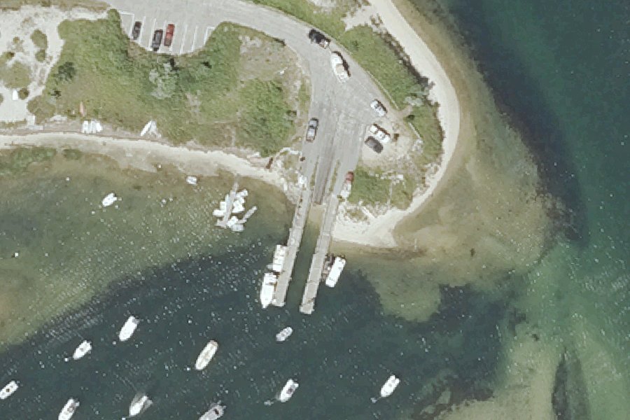
Menemsha Pond Boat Ramp is a boat ramp open to residents or permit holders on Menemsha Pond near Aquinnah, Massachusetts.
- Residents or permit only
- 12 trailer spaces
- Paved ramp
Public, but limited to residents, sticker or permit holders (on tribal land, a tribal permit). The agency notes: “Limited non resident parking with fee”. Check the rules with the town, tribe or agency before you go.
Status not reported No closure has been posted for this launch, but its agency does not publish open or closed status. Check with the managing agency before you tow.
At the launch
- Type
- Boat ramp
- Ramp surface
- Paved
- Trailer parking
- 12 spaces
- Coordinates
- 41.35185, -70.76760
Channel depths in feet from the Army Corps' surveys (New England District; the one nearest this launch is of October 24, 2025). Not for navigation.
Conditions
- Weather forecast for this launch · National Weather Service
Channel survey
The Army Corps surveys the channels it maintains and posts every survey.
- Menemsha Creek · 0.1 mi from this launch
Condition survey of October 24, 2025 by the New England District. Least depth in the channel (8-Foot Channel Edys Island Reach): 2.3 ft below mean lower low water (MLLW); project depth 8 ft. Survey sheet (PDF)
US Army Corps of Engineers hydrographic surveys, from eHydro. A survey shows the bottom on the day it was made; channels shoal after high water and change with dredging. Not for navigation.
On Menemsha Pond
Pond in Massachusetts. All launches on Menemsha Pond.
Community
Where people who use Menemsha Pond talk about it.
Nearby launches
- Menemsha Pond Boat Launch · 0.9 mi · Menemsha Pond
- Town of Chilmark Landing (State Road) · 1.7 mi · Nashaquitsa Pond
- Dogfish Bar · 2.1 mi · Vineyard Sound
- Squibnocket Pond Boat Launch · 2.4 mi · Squibnocket Pond
- Great Rock Bight Shorefish Access · 2.5 mi · Vineyard Sound
- Tisbury Great Pond Boat Launch · 5.9 mi · Tisbury Great Pond
Sources
- Massachusetts Coastal Boat Ramps (Division of Marine Fisheries) record menemsha-pond-aquinnah-west-basin-rd · Permission is granted to copy and use the materials herein (EEA and DFG, ArcGIS item f6e06b2f636a455f9037e17aaeaa448a)
- OpenStreetMap w1062721617 © OpenStreetMap contributors, ODbL
Why it is listed as public: listed by Massachusetts Coastal Boat Ramps (Division of Marine Fisheries). Something wrong, or is this launch private? Send a correction; it goes to a person.