
Massachusetts / Littleville Lake /
Huntington Boat Ramp
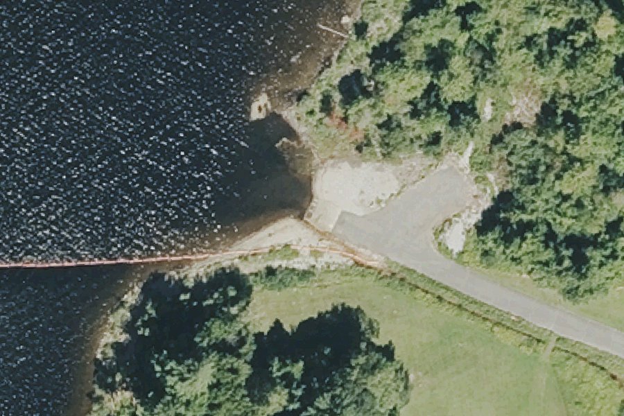
Huntington Boat Ramp is a public boat ramp on Littleville Lake near Huntington, Massachusetts, run by the U.S. Army Corps of Engineers.
- Up to 10 hp
- Paved ramp
Open per U.S. Army Corps of Engineers recreation area status's data, checked June 8, 2026. Seasonal gates, low water and storms are not always posted; check before you tow.
At the launch
- Type
- Boat ramp
- Motors
- Up to 10 hp
- Ramp surface
- Concrete
- Managed by
- U.S. Army Corps of Engineers
- Coordinates
- 42.26890, -72.88001
Depth contours in feet from MassWildlife. Not for navigation.
Boating rules
- there is a 10 Hp. limit on motors. · all of Littleville Lake rule
From the boating rules map of Massachusetts Division of Fisheries and Wildlife (MassWildlife), read October 18, 2026. A map of rules is a guide: the regulation's text and the posted signs govern.
Conditions
- Weather forecast for this launch · National Weather Service
- Lake level at Littleville Dam · USACE
Lake level: Littleville Lake
Today's level loads here; without it, see the agency's page below.
Level from U.S. Army Corps of Engineers, Corps Water Management System (Littleville Dam), about hourly; the agency's page. Levels change; check conditions at the ramp before you launch.
On Littleville Lake
Reservoir in Massachusetts. All launches on Littleville Lake.
Nearby launches
- Dayville Boat Ramp · 2.0 mi · Middle Branch Westfield River
- Westfield River Reservoir Carry-in Access near Huntington · 3.0 mi · Westfield River Reservoir
- Westfield River Reservoir Carry-in Access near Montgomery · 3.3 mi · Westfield River Reservoir
- Norwich Pond Boat Launch · 3.7 mi · Norwich Pond
- Westfield River Reservoir Carry-in Access near Russell · 5.6 mi · Westfield River Reservoir
- Westfield River Carry-in Access near Russell · 6.3 mi · Westfield River
Sources
- U.S. Army Corps of Engineers boat ramps (FHWA Federal Lands Transportation Facility Inventory) record 1260-155381-7-001 · US federal government data, public domain (FHWA Federal Lands Transportation Facility Inventory, U.S. Army Corps of Engineers submittal)
- MassWildlife GoFishMA! freshwater access points record GFACC750 · Public data (MassWildlife, Massachusetts Division of Fisheries and Wildlife), no license stated
- U.S. Army Corps of Engineers recreation area status open or closed status · US federal government data, public domain (U.S. Army Corps of Engineers Natural Resource Management Program)
- OpenStreetMap n9722616682 © OpenStreetMap contributors, ODbL
Why it is listed as public: listed by U.S. Army Corps of Engineers boat ramps (FHWA Federal Lands Transportation Facility Inventory) and MassWildlife GoFishMA! freshwater access points. Something wrong, or is this launch private? Send a correction; it goes to a person.