
Florida / Little Manatee River /
Camp Bayou Canoe and Kayak Launch
Camp Bayou Canoe and Kayak Launch is a public kayak and canoe launch on the Little Manatee River near Ruskin, Florida.
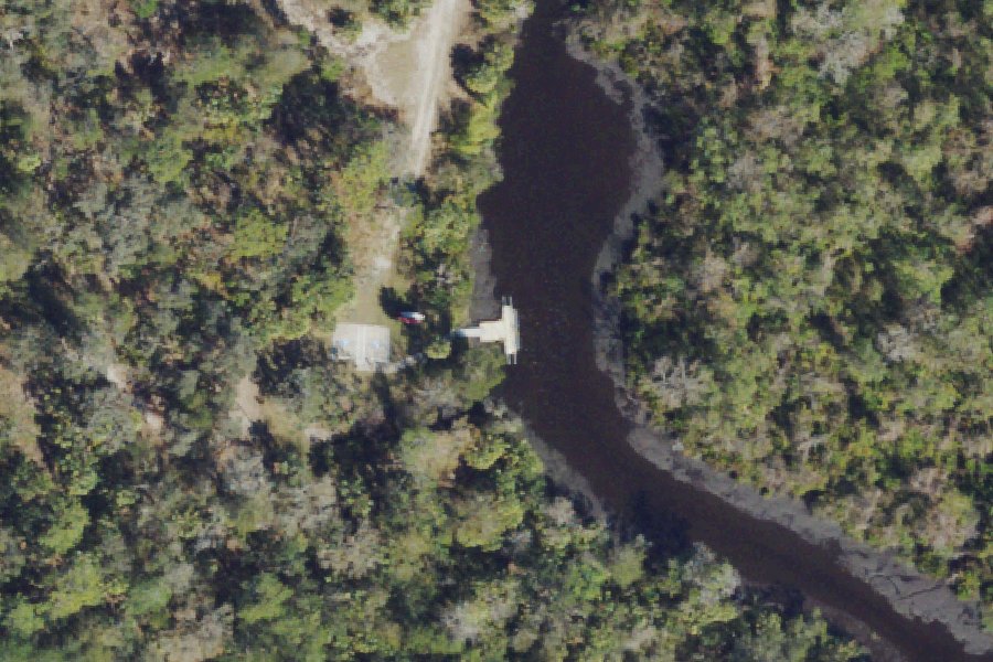
Status not reported No closure has been posted for this launch, but its agency does not publish open or closed status. Check with the managing agency before you tow.
At the launch
- Type
- Carry-in (canoe and kayak)
- Coordinates
- 27.66530, -82.39975
Boating rules
- Manatee zone: 25 MPH (All Year) · all of Little Manatee River rule
From the boating rules map of Florida Fish and Wildlife Conservation Commission, read October 18, 2026. A map of rules is a guide: the regulation's text and the posted signs govern.
Conditions
- Weather forecast for this launch · National Weather Service
- Water level, flow at the LITTLE MANATEE RIVER AT US 301 NEAR WIMAUMA, FL gauge · USGS, 2.9 mi away on Little Manatee River
Water level
Latest reading loads here; without it, see the USGS page below.
USGS gauge LITTLE MANATEE RIVER AT US 301 NEAR WIMAUMA, FL, 2.9 mi from this launch on Little Manatee River: water level, flow, a reading every 15 minutes. Readings and history at USGS.
On Little Manatee River
The Little Manatee River is a free-flowing blackwater river on the west-central Florida peninsula. It runs east to west across southern Hillsborough County, briefly dips into Manatee County, and empties into Tampa Bay. It rises east of Fort Lonesome and passes Wimauma, Sun City Center and Ruskin on its way to the bay. Wikipedia gives its length as 41 miles, Florida State Parks says almost 40 miles, and the USF Water Atlas lists 50.3 miles. The river drains a 243-square-mile watershed, and its lower 5 miles are tidal. Over that course it widens from a creek 10 to 20 feet across to a tidal river about 300 feet wide. The Florida Department of Environmental Protection has designated it an Outstanding Florida Water. Parts of the river lie within Little Manatee River State Park and the Cockroach Bay Aquatic Preserve. More about Little Manatee River.
Boating rules on Little Manatee River
- Posted idle-speed and slow-speed (no-wake) zones must be obeyed near the Domino ramp source
- Posted idle-speed and slow-speed (no-wake) zones must be obeyed near the Wildcat Creek ramp source
- FWC manatee protection zones (rule 68C-22.013 F.A.C.) on the lower river, including slow-speed and seasonal idle-speed zones (Nov 15 - Mar 31) source
- $5 boat launch fee at Hillsborough County ramps (annual passes available) source
- No swimming, wading or diving at the county boat ramps source
Community
Where people who use Little Manatee River talk about it.
- Friends of The Little Manatee River Park Association
- Friends of the Little Manatee River Association
- Friends of the Little Manatee River (Facebook page) Facebook
- Little Manatee River State Park (Facebook page) Facebook
- Little Manatee River State Park - Experiences & Amenities (canoe launch status) Agency
- Camp Bayou Outdoor Learning Center Association
- Little Manatee River - Hillsborough County Water Atlas Link
- Search Reddit: r/florida Reddit
- Search all of Reddit for Little Manatee River, Florida Reddit
Nearby launches
- Camp Bayou Nature Preserve Canoe Launch · 0.2 mi · Little Manatee River
- Little Manatee River State Park Canoe/Kayak Launch · 0.8 mi · Little Manatee River
- Little Manatee River State Park - Pavillion #1 Alternative Canoe Launch (Call Office) · 1.4 mi · Little Manatee River
- Little Manatee River State Park - River Steps Canoe Launch (TEMPORARILY CLOSED) · 1.6 mi · Little Manatee River
- Wildcat Creek Park Public Boat Ramp · 2.4 mi · Little Manatee River
- Domino Public Boat Ramp · 3.4 mi · Little Manatee River
Sources
- OpenStreetMap n2690125565 © OpenStreetMap contributors, ODbL
Why it is listed as public: tampabay.wateratlas.usf.edu: the kayak and canoe launch inside the nature center compound is now open seven days a week so visitors can continue to enjoy daily river access. Something wrong, or is this launch private? Send a correction; it goes to a person.