
Algonac Municipal Ramp
Algonac Municipal Ramp is a public boat ramp on Lake Saint Clair near Algonac, Michigan, run by the city.
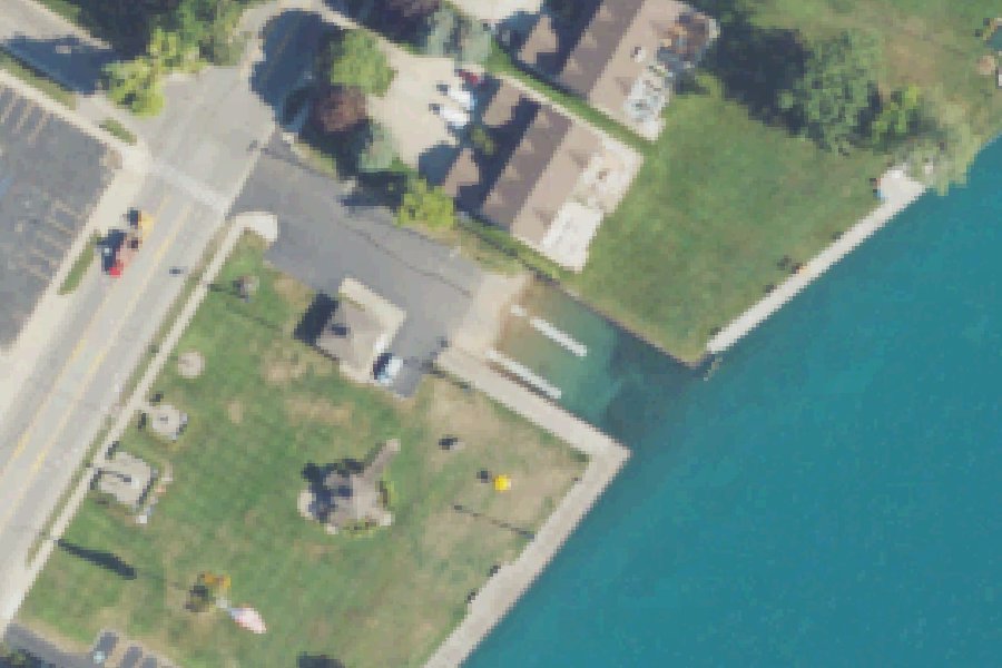
Status not reported No closure has been posted for this launch, but its agency does not publish open or closed status. Check with the managing agency before you tow.
At the launch
- Type
- Boat ramp
- Car parking
- 7 spaces
- Restrooms
- No
- Managed by
- City
- Coordinates
- 42.62004, -82.52878
Boating rules
- Slow, no-wake speed · a zone at or next to this launch rule
From the boating rules map of Michigan Department of Natural Resources, read October 18, 2026. A map of rules is a guide: the regulation's text and the posted signs govern.
Conditions
- Weather forecast for this launch · National Weather Service
Marine advisories
Advisories in effect load here; without them, see the NWS zone forecast below.
National Weather Service marine zone LCZ422, St. Clair River. Zone forecast: winds, seas, warnings.
On Lake Saint Clair
Lake St. Clair is a natural freshwater lake on the border between Michigan and Ontario. It is part of the Great Lakes system but is not counted as one of the five Great Lakes. Together with the St. Clair River and the Detroit River, it links Lake Huron to the north with Lake Erie to the south. The lake covers about 430 square miles and is shallow, with an average depth of 11 feet and a maximum depth of 27 feet, according to Wikipedia. Macomb County gives 10 and 21 feet. US and Canadian agencies have kept a 30-foot-deep shipping channel through the lake for more than a century. The St. Clair River enters the lake through a delta of North, Middle and South channels. The North Channel runs past Harsens and Dickinson islands and empties into Anchor Bay. Macomb County has 32 miles of the western shoreline. More about Lake Saint Clair.
Boating rules on Lake Saint Clair
- St. Clair River (from the mouth of the Black River down to the mouth of the St. Clair River): slow-no-wake within 200 ft of any shore, dock or pierhead for vessels under 26 ft long; within 600 ft for vessels 26 ft or longer (Michigan-enforced) source
- North (Lac Sainte Claire) and South (Blossom Heath) boat launches in St. Clair Shores are open to St. Clair Shores residents only source
Community
Where people who use Lake Saint Clair talk about it.
- Lake St. Clair Fisheries Research Station (Michigan DNR) Agency
- Lake St. Clair - Macomb County Agency
- Lake St. Clair Walleye Association Club
- Lake St. Clair Walleye Association (Facebook) Facebook
- Michigan-Ontario Muskie Club Club
- Lake St. Clair Fishing Forum Forum
- Lake St. Clair Fishing Facebook
- Lake St. Clair Fishing Reports Facebook
- Boating On Lake St. Clair Facebook
- Search Reddit: r/Michigan Reddit
- Search all of Reddit for Lake Saint Clair, Michigan Reddit
Nearby launches
- North Channel · 1.2 mi · Lake Saint Clair
- Algonac State Park · 2.0 mi · Saint Clair River
- St. Johns Marsh Boat Launch · 3.9 mi · Lake Saint Clair
- Ames · 4.0 mi · Lake Saint Clair
- Marine City · 5.9 mi · Saint Clair River
- Snooks · 6.2 mi · Lake Saint Clair
Sources
- Michigan DNR Boat Launches (DNR inventory layer) record A-74-015 · Public record of the State of Michigan; no restrictions on use stated
- Great Lakes Commission Boat Access Sites (compilation, public and private) record -82.52890,42.62001 · CC BY 4.0 (Great Lakes Commission compilation); coverage and attribute completeness vary by jurisdiction
- OpenStreetMap w1423971283 © OpenStreetMap contributors, ODbL
- OpenStreetMap n185974408 © OpenStreetMap contributors, ODbL
Why it is listed as public: listed by Michigan DNR Boat Launches (DNR inventory layer) and Great Lakes Commission Boat Access Sites (compilation, public and private). Something wrong, or is this launch private? Send a correction; it goes to a person.