
Lake Leelanau South
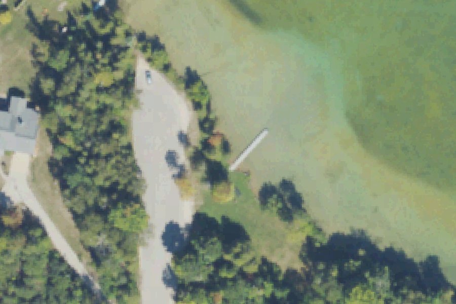
Lake Leelanau South is a public boat ramp on Lake Leelanau near Lake Leelanau, Michigan, run by the township.
Zebra mussels (latest report 2017) reported in this water (USGS Nonindigenous Aquatic Species database). Clean, drain and dry your boat, trailer and gear before you leave, and do not move water, plants or live bait to another water.
USGS Nonindigenous Aquatic Species database · checked October 20, 2026
Status not reported No closure has been posted for this launch, but its agency does not publish open or closed status. Check with the managing agency before you tow.
At the launch
- Type
- Boat ramp
- Car parking
- 5 spaces
- Restrooms
- No
- Managed by
- Township
- Coordinates
- 44.99089, -85.73376
Depth contours in feet from Michigan DNR. Not for navigation.
Conditions
- Weather forecast for this launch · National Weather Service
On Lake Leelanau
Lake Leelanau is a lake in the middle of the Leelanau Peninsula in Leelanau County, Michigan. It is sometimes also called Carp Lake. The Narrows splits it into North Lake Leelanau and South Lake Leelanau at the community of Lake Leelanau, where M-204 crosses on a bridge. The lake covers about 8,608 acres and runs about 16.3 miles, measuring 1.5 miles at its widest point. The south basin covers 5,693 acres and is up to 62 feet deep. The north basin covers 2,914 acres and is up to 121 feet deep. The south end is a marsh near Cedar. The lake drains through the Leland River, also called the Carp River, which runs about a mile to Lake Michigan at Leland. A dam built on the river in 1854 raised the lake by as much as 12 feet. Leelanau County owns the Leland Dam. Under a 1978 court order the lake is held at 589.21 feet from April 15 (or the last ice) and lowered to 588.21 feet after November 15. The lake's watershed covers about 89,000 acres. More about Lake Leelanau.
Boating rules on Lake Leelanau
- Slow-no wake speed in the Lake Leelanau Narrows, as marked with buoys source
- Slow-no wake speed on the Carp (Leland) River from the M-22 bridge upstream to 150 feet into the north arm of Lake Leelanau source
- Michigan law: do not launch or transport watercraft or trailers unless free of aquatic organisms; remove drain plugs and drain bilges, ballast tanks and livewells before transport; do not release bait source
- Lake association guidance: do not tow people through the Lake Leelanau Narrows source
Community
Where people who use Lake Leelanau talk about it.
- Lake Leelanau Lake Association Association
- Lake Leelanau Lake Association (Facebook) Facebook
- Friends of Lake Leelanau (Facebook) Facebook
- Leland Dam Authority - Leelanau County Agency
- Lake Levels - Lake Leelanau Lake Association (live sensors) Link
- Fishing Archives - Lake Leelanau Lake Association Link
- Fishing North and South Lake Leelanau - Michigan Sportsman forum Forum
- Search Reddit: r/Michigan Reddit
- Search all of Reddit for Lake Leelanau, Michigan Reddit
Nearby launches
- The Narrows · 1.4 mi · Lake Leelanau
- Carp River · 2.5 mi · Leland River
- Leeland Township Marina · 2.7 mi · Lake Michigan
- Lake Leelanau North · 3.9 mi · Lake Leelanau
- Suttons Bay Marina · 4.3 mi · Lake Michigan
- Lake Leelanau West · 5.3 mi · Lake Leelanau
Sources
- Michigan DNR Boat Launches (DNR inventory layer) record A-45-005 · Public record of the State of Michigan; no restrictions on use stated
- Great Lakes Commission Boat Access Sites (compilation, public and private) record -85.73411,44.99111 · CC BY 4.0 (Great Lakes Commission compilation); coverage and attribute completeness vary by jurisdiction
- OpenStreetMap n10781871013 © OpenStreetMap contributors, ODbL
Why it is listed as public: listed by Michigan DNR Boat Launches (DNR inventory layer) and Great Lakes Commission Boat Access Sites (compilation, public and private). Something wrong, or is this launch private? Send a correction; it goes to a person.