
New Richmond
New Richmond is a public boat ramp on the Kalamazoo River near New Richmond, Michigan, run by the Michigan DNR Parks and Recreation.
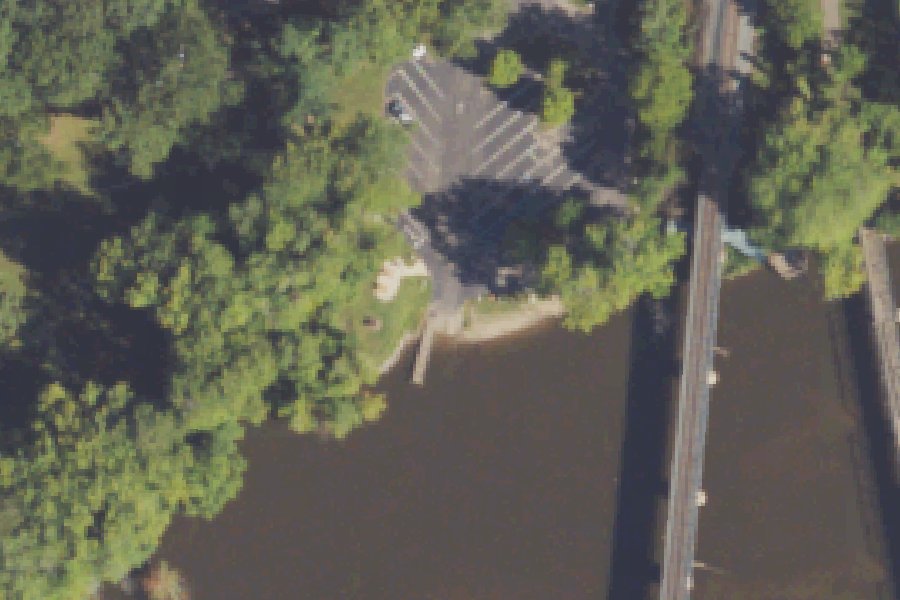
Status not reported No closure has been posted for this launch, but its agency does not publish open or closed status. Check with the managing agency before you tow.
At the launch
- Type
- Boat ramp
- Car parking
- 18 spaces
- Restrooms
- No
- Managed by
- Michigan DNR Parks and Recreation
- Coordinates
- 42.65173, -86.10777
Conditions
- Weather forecast for this launch · National Weather Service
- Water level, flow, water temperature at the KALAMAZOO RIVER AT NEW RICHMOND, MI gauge · USGS, 0.1 mi away on Kalamazoo River
Water level
Latest reading loads here; without it, see the USGS page below.
USGS gauge KALAMAZOO RIVER AT NEW RICHMOND, MI, 0.1 mi from this launch on Kalamazoo River: water level, flow, water temperature, a reading every 15 minutes. Readings and history at USGS.
On Kalamazoo River
The Kalamazoo River is a river in southwest Michigan. It runs 130 miles from the point where its north and south branches join at Albion to its mouth at Lake Michigan, near Saugatuck and Douglas. Its watershed covers about 2,020 square miles across parts of ten counties. From Albion the river flows mostly west through Marshall, Battle Creek, Augusta, Galesburg, Comstock and Kalamazoo. It then turns north toward Plainwell and flows northwest through Otsego and Allegan. Larger tributaries include the Battle Creek River, Portage Creek, the Gun River and the Rabbit River. Near Allegan, the Calkins Bridge Dam, also called the Allegan Hydroelectric Plant, holds back Lake Allegan, which covers almost 1,600 acres. More about Kalamazoo River.
Community
Where people who use Kalamazoo River talk about it.
- Kalamazoo River Watershed Council Association
- Kalamazoo River Watershed Council (Facebook) Facebook
- Allied Paper, Inc./Portage Creek/Kalamazoo River Superfund Site - US EPA Agency
- Kalamazoo River Watershed Council water trail - Michigan Water Trails Link
- Search Reddit: r/Michigan Reddit
- Search all of Reddit for Kalamazoo River, Michigan Reddit
Nearby launches
- Hacklander · 3.0 mi · Kalamazoo River
- Howard Schultz Park · 4.2 mi · Kalamazoo Lake
- Main Ottawa Landing · 4.4 mi · Big Dailey Bayou
- Goshorn Lake road end (65th Street) · 4.5 mi · Goshorn Lake
- Kalamazoo Lake Boat Launch near Douglas · 4.6 mi · Kalamazoo Lake
- Kalamazoo Lake Carry-in Access · 4.6 mi · Kalamazoo Lake
Sources
- Michigan DNR Boat Launches (DNR inventory layer) record A-03-011 · Public record of the State of Michigan; no restrictions on use stated
- Great Lakes Commission Boat Access Sites (compilation, public and private) record -86.10771,42.65171 · CC BY 4.0 (Great Lakes Commission compilation); coverage and attribute completeness vary by jurisdiction
- OpenStreetMap w1237262367 © OpenStreetMap contributors, ODbL
- OpenStreetMap n13735174661 © OpenStreetMap contributors, ODbL
Why it is listed as public: listed by Michigan DNR Boat Launches (DNR inventory layer) and Great Lakes Commission Boat Access Sites (compilation, public and private). Something wrong, or is this launch private? Send a correction; it goes to a person.