
Michigan / Huron River /
Willow Metropark Canoe/Kayak Launch
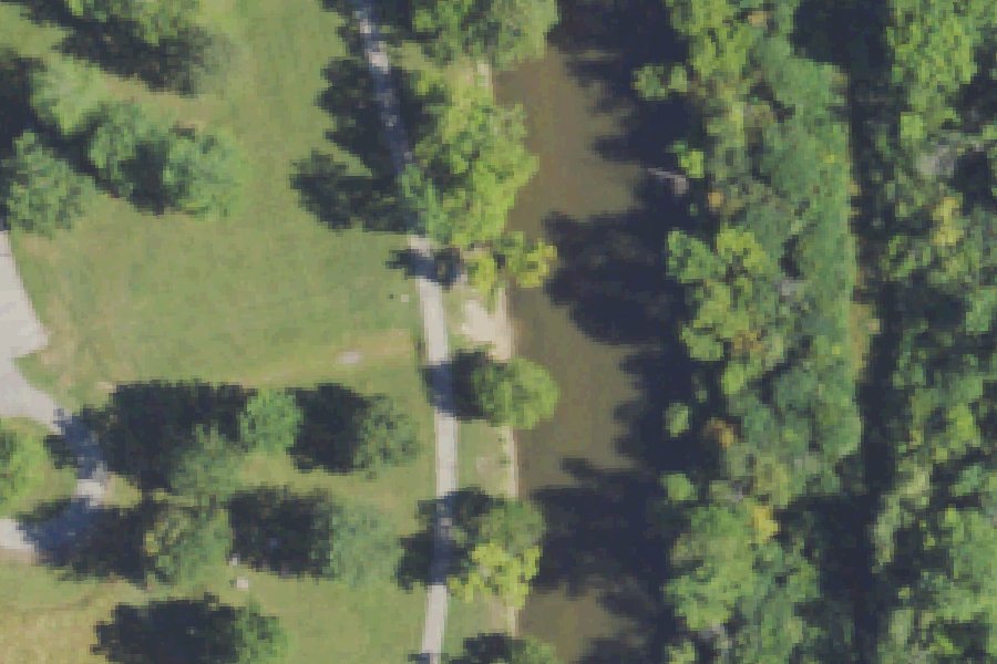
Willow Metropark Canoe/Kayak Launch is a public kayak and canoe launch on the Huron River near Huron Charter Township, Michigan.
Status not reported No closure has been posted for this launch, but its agency does not publish open or closed status. Check with the managing agency before you tow.
At the launch
- Type
- Carry-in (canoe and kayak)
- Coordinates
- 42.12816, -83.36010
Depth contours in feet from Michigan DNR. Not for navigation.
Boating rules
- Slow, no-wake speed · all of Huron River rule
From the boating rules map of Michigan Department of Natural Resources, read October 18, 2026. A map of rules is a guide: the regulation's text and the posted signs govern.
Conditions
- Weather forecast for this launch · National Weather Service
On the river
Keep well clear of dams: strong currents and restricted zones above and below them.
- Dam, 5.9 mi downstream: Flat Rock Dam, 16.5 ft. · Michigan EGLE dam inventory
- Dam, 7.8 mi upstream: Lower Pond Dam. · Michigan EGLE dam inventory
Up to 10 river miles each way, from the agencies' inventories; not every hazard is listed and rivers change. Scout before you go.
Sources: Michigan EGLE dam inventory.
On Huron River
The Huron River is a river in southeastern Michigan, about 130 miles long. It rises in the Huron Swamp in Springfield Township in northern Oakland County, flows through Livingston, Washtenaw, Wayne and Monroe counties, and enters Lake Erie southeast of Rockwood. Its lower reach forms the boundary between Wayne and Monroe counties. Its watershed covers 908 square miles, and the river passes through Dexter, Ann Arbor, Ypsilanti, Belleville and Flat Rock. There are 19 dams on the main stem. Lakes formed behind dams on the main stem include Kent Lake (Kent Lake Dam, 1946), Barton Pond, Argo Pond, Ford Lake, Belleville Lake and Flat Rock Pond. It is the only state-designated Country-Scenic Natural River in southeast Michigan. More about Huron River.
Boating rules on Huron River
- Portage required around the dam within Island Lake Recreation Area source
- Flook Dam portage (Portage Lake chain, near River Mile 69) closed for the 2026 paddling season source
- Barton Dam portage and Barton Pond access (Ann Arbor, River Mile 54) closed until 2027 source
- McCabe Road bridge (Green Oak Township, River Miles 84-83) temporarily closed to paddling during bridge work in 2026 source
- PFAS 'Do Not Eat Fish' advisory (2018) and 'Avoid Swallowing Foam' advisory apply to the river source
Community
Where people who use Huron River talk about it.
- Huron River Watershed Council Association
- Huron River National Water Trail Association
- River Conditions - Huron River National Water Trail Link
- Island Lake Recreation Area - Michigan DNR Agency
- Huron River Water Trail (Facebook) Facebook
- Huron River Watershed Council (Facebook) Facebook
- Huron River Fishing Association, Flat Rock (Facebook) Club
- Search Reddit: r/Michigan Reddit
- Search all of Reddit for Huron River, Michigan Reddit
Nearby launches
- Oakwoods Metropark Canoe/Kayak Launch (Cedar Knoll) · 1.9 mi · Huron River
- Huron River Carry-in Access near Romulus · 4.2 mi · Huron River
- Belleville Boat Launch · 8.3 mi · Belleville Lake
- Lake Erie Metropark · 9.1 mi · Lake Erie
- Elizabeth Park · 9.3 mi · Detroit River
- Harrison Ave · 9.6 mi · Detroit River
Sources
- OpenStreetMap n666491062 © OpenStreetMap contributors, ODbL
Why it is listed as public: www.metroparks.com: Launch is located near the Big Bend picnic area.. Something wrong, or is this launch private? Send a correction; it goes to a person.