
Michigan / Betsie River /
Homestead Pond
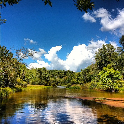
Homestead Pond is a public boat ramp on the Betsie River near Benzonia, Michigan.
Status not reported No closure has been posted for this launch, but its agency does not publish open or closed status. Check with the managing agency before you tow.
Conditions
- Weather forecast for this launch · National Weather Service
On the river
Keep well clear of dams: strong currents and restricted zones above and below them.
- Dam, 0.4 mi downstream: Homestead Dam, 14 ft. · Michigan EGLE dam inventory
Up to 10 river miles each way, from the agencies' inventories; not every hazard is listed and rivers change. Scout before you go.
Sources: Michigan EGLE dam inventory.
On Betsie River
The Betsie River is a 54-mile river in the northwestern Lower Peninsula of Michigan. Most sources place its source at the outflow of Green Lake, between Karlin and Interlochen in Grand Traverse County. From there it runs southwest into Benzie County, passes briefly through northern Manistee County, and turns north back into Benzie County. Near the mouth it widens into Betsie Lake and then enters Lake Michigan between Frankfort and Elberta. The river drains about 155,026 acres and is part of Michigan's Natural Rivers Program. The Grass Lake Dam, built by the state Wildlife Division in 1951, holds back an impoundment of about 90 acres roughly 4 miles below Green Lake. Downstream, the former Consumers Energy power dam at Homestead was mostly removed in 1974 and now serves as a sea lamprey barrier. The old Thompsonville Dam failed in 1989 and was removed. More about Betsie River.
Boating rules on Betsie River
- Fishing closed within 300 feet of the Homestead Dam lamprey barrier and fish passage facility from August 1 to November 15 (DNR regulation, effective 2020) source
Community
Where people who use Betsie River talk about it.
Nearby launches
- Homestead Dam · 0.2 mi · Betsie River
- US 31 · 1.1 mi · Betsie River
- Grace Road · 2.0 mi · Betsie River
- River Road · 2.8 mi · Betsie River
- Crystal Lake Boat Launch · 3.9 mi · Crystal Lake
- Shorter Lake · 4.6 mi · Crystal Lake
Sources
- Michigan DNR Boat Launches (DNR inventory layer) record A-10-018 · Public record of the State of Michigan; no restrictions on use stated
Why it is listed as public: listed by Michigan DNR Boat Launches (DNR inventory layer). Something wrong, or is this launch private? Send a correction; it goes to a person.