
Golson Boat Launch
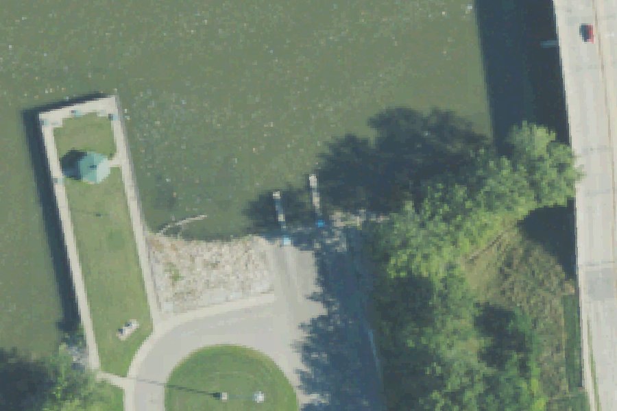
Golson Boat Launch is a public boat ramp on the Saginaw River near Bay City, Michigan.
Zebra mussels (latest report 2017) reported in Saginaw River 1.9 km from this launch (USGS Nonindigenous Aquatic Species database). Clean, drain and dry your boat, trailer and gear before you leave, and do not move water, plants or live bait to another water.
USGS Nonindigenous Aquatic Species database · checked October 20, 2026
Status not reported No closure has been posted for this launch, but its agency does not publish open or closed status. Check with the managing agency before you tow.
At the launch
- Type
- Boat ramp
- Website
- baycountymi.gov
- Coordinates
- 43.61203, -83.87344
Channel depths in feet from the Army Corps' surveys (Detroit District; the one nearest this launch is of June 22, 2026). Not for navigation.
Conditions
- Weather forecast for this launch · National Weather Service
- Water level, flow at the SAGINAW RIVER AT MIDLAND STREET AT BAY CITY, MI gauge · USGS, 1.2 mi away on Saginaw River
Water level
Latest reading loads here; without it, see the USGS page below.
USGS gauge SAGINAW RIVER AT MIDLAND STREET AT BAY CITY, MI, 1.2 mi from this launch on Saginaw River: water level, flow, a reading every 15 minutes. Readings and history at USGS.
Channel survey
The Army Corps surveys the channels it maintains and posts every survey.
- Saginaw River · 0.1 mi from this launch
Condition survey of June 22, 2026 by the Detroit District. Least depth in the channel (W Sixth Street Turning Basin): 9.9 ft; project depth 20 ft. Survey sheet (PDF)
US Army Corps of Engineers hydrographic surveys, from eHydro. A survey shows the bottom on the day it was made; channels shoal after high water and change with dredging. Not for navigation.
On Saginaw River
The Saginaw River is a 22.4-mile river in Saginaw and Bay counties, Michigan. It begins southwest of Saginaw, where the Tittabawassee and Shiawassee rivers meet, and flows north through Saginaw, Zilwaukee, Bay City and Essexville. It empties into Saginaw Bay of Lake Huron at the boundary of Bangor and Hampton townships. The river drains a watershed of 8,595 square miles, and its estimated average discharge at the mouth is 4,827 cubic feet per second. It is one of Michigan's few inland navigable rivers and remains a commercial shipping route, carrying an estimated 4.6 million tons of commerce a year. More about Saginaw River.
Boating rules on Saginaw River
- No-wake zone on the Saginaw River between Salzburg Road and M-25 in Bay City (city ordinance, 2016) source
Community
Where people who use Saginaw River talk about it.
- Saginaw River/Bay AOC - Michigan EGLE Agency
- Saginaw River at Holland Avenue at Saginaw, MI - USGS Water Data Link
- Saginaw River Marine Historical Society Facebook
- Saginaw Bay Watershed Initiative Network Facebook
- Saginaw River No Wake Zones - Michigan Sportsman forum Forum
- Hotspots on Saginaw River - Michigan Sportsman forum Forum
- Search Reddit: r/Michigan Reddit
- Search all of Reddit for Saginaw River, Michigan Reddit
Nearby launches
- Independence County Park · 0.2 mi · Saginaw River
- Veterans Memorial Park · 1.4 mi · Saginaw River
- Smith Park · 1.4 mi · Saginaw River
- Saginaw River Mouth · 2.3 mi · Saginaw River
- Jones Road · 3.2 mi
- Finn Road Park · 4.8 mi · Lake Huron
Sources
- OpenStreetMap n7609587040 © OpenStreetMap contributors, ODbL
Why it is listed as public: www.baycountymi.gov: It provides two boat launch platforms and a ramp specifically designed for handicap accessibility.. Something wrong, or is this launch private? Send a correction; it goes to a person.