
Connecticut / Connecticut River /
Ely's Ferry Landing
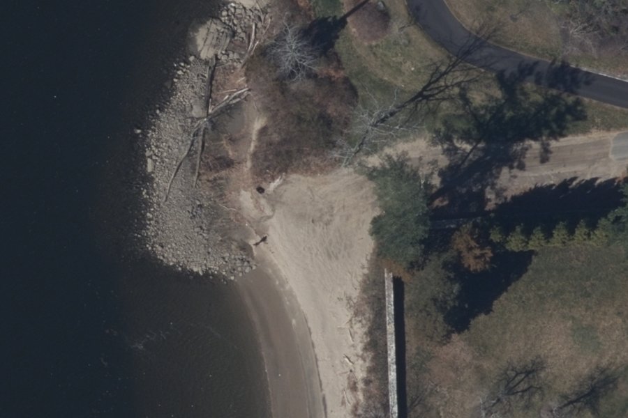
Ely's Ferry Landing is a free public kayak and canoe launch on the Connecticut River near Lyme, Connecticut, run by Town of Lyme.
- Free
- Tidal
Status not reported No closure has been posted for this launch, but its agency does not publish open or closed status. Check with the managing agency before you tow.
At the launch
- Type
- Carry-in (canoe and kayak)
- Fee
- Free
- Restrooms
- No
- Tidal
- Yes
- Wheelchair access
- No
- Managed by
- Town of Lyme
- Website
- townlyme.org
- Coordinates
- 41.36339, -72.37578
Channel depths in feet from the Army Corps' surveys (New England District; the one nearest this launch is of July 2, 2025). Not for navigation.
Conditions
- Weather forecast for this launch · National Weather Service
- Tide predictions at Essex · NOAA, 1.1 mi away
Marine advisories
Advisories in effect load here; without them, see the NWS zone forecast below.
National Weather Service marine zone ANZ332, Long Island Sound East of the Mouth of the Connecticut River. Zone forecast: winds, seas, warnings.
Tides
Predicted highs and lows at NOAA's Essex station, 1.1 mi from this launch, in local time above MLLW. Predictions, not observations: wind and weather move the real tide. Full predictions at NOAA.
| Mon Nov 2 | High 4:38 am 2.9 ft · Low 11:05 am 0.6 ft · High 5:10 pm 3.3 ft · Low 11:47 pm 0.3 ft |
|---|---|
| Tue Nov 3 | High 5:49 am 3.1 ft · Low 12:13 pm 0.6 ft · High 6:17 pm 3.1 ft |
| Wed Nov 4 | Low 12:42 am 0.2 ft · High 6:51 am 3.3 ft · Low 1:16 pm 0.5 ft · High 7:14 pm 3.1 ft |
| Thu Nov 5 | Low 1:34 am 0.2 ft · High 7:42 am 3.5 ft · Low 2:15 pm 0.4 ft · High 8:03 pm 3.0 ft |
| Fri Nov 6 | Low 2:23 am 0.3 ft · High 8:27 am 3.7 ft · Low 3:08 pm 0.3 ft · High 8:48 pm 2.9 ft |
| Sat Nov 7 | Low 3:09 am 0.3 ft · High 9:09 am 3.8 ft · Low 3:57 pm 0.2 ft · High 9:32 pm 2.8 ft |
| Sun Nov 8 | Low 3:52 am 0.4 ft · High 9:50 am 3.8 ft · Low 4:40 pm 0.1 ft · High 10:15 pm 2.8 ft |
Channel survey
The Army Corps surveys the channels it maintains and posts every survey.
- Connecticut River Saybrook to Haddam
Condition survey of July 2, 2025 by the New England District. Least depth in the channel (15-Foot Essex Shoal): 9.1 ft below mean lower low water (MLLW); project depth 15 ft. Survey sheet (PDF)
US Army Corps of Engineers hydrographic surveys, from eHydro. A survey shows the bottom on the day it was made; channels shoal after high water and change with dredging. Not for navigation.
On Connecticut River
The Connecticut River is the longest river in New England. It flows roughly south for 406 miles through four states and empties into Long Island Sound between Old Saybrook and Old Lyme, Connecticut. Its watershed covers 11,260 square miles and includes 148 tributaries. The river supplies about 70 percent of Long Island Sound's fresh water. Tides reach as far north as the Enfield Rapids in Windsor Locks, about 58 miles above the mouth. Hartford, the only state capital on the river, sits on an old floodplain that runs south to Middletown. At Middletown the river narrows and turns southeast, passing through thinly populated, hilly, wooded country before it widens into coastal marshland at the Sound. Large sandbars that shift at the mouth make the Connecticut the only major river in the Northeast without a port at its mouth. More about Connecticut River.
Community
Where people who use Connecticut River talk about it.
Nearby launches
- Little Point Street · 0.8 mi · North Cove
- Bushnell Park · 0.9 mi · Falls River
- Essex Town Dock · 1.0 mi · Falls River
- Scholes Lane Water Access Area · 1.1 mi · Middle Cove
- Nott Lane Open Space · 1.1 mi · Middle Cove
- Essex Town Park · 1.1 mi · Middle Cove
Sources
- Connecticut DEEP Coastal Access Sites (boat launches and car-top access) record 396 · No access or use limitations (layer metadata, ArcGIS item d8eb7731d7d84a149917809241f970ec)
Why it is listed as public: listed by Connecticut DEEP Coastal Access Sites (boat launches and car-top access). Something wrong, or is this launch private? Send a correction; it goes to a person.