
Massachusetts / Bourne Wharf River /
Cove Street Boat Ramp
Cove Street Boat Ramp is a public boat ramp on the Bourne Wharf River near Duxbury, Massachusetts.
- 3 trailer spaces
- Tidal
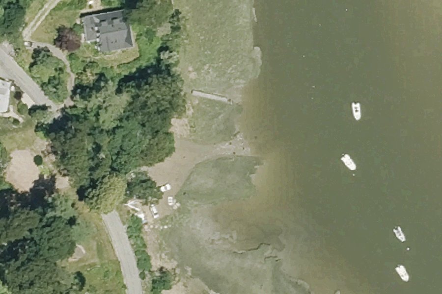
Status not reported No closure has been posted for this launch, but its agency does not publish open or closed status. Check with the managing agency before you tow.
At the launch
- Type
- Boat ramp
- Ramp surface
- Sand
- Trailer parking
- 3 spaces
- Tidal
- Yes
- Coordinates
- 42.05215, -70.67143
Conditions
- Weather forecast for this launch · National Weather Service
- Tide predictions at Duxbury, Duxbury Harbor · NOAA, 0.9 mi away
Marine advisories
Advisories in effect load here; without them, see the NWS zone forecast below.
National Weather Service marine zone ANZ251, Massachusetts Bay and Ipswich Bay. Zone forecast: winds, seas, warnings.
Tides
Predicted highs and lows at NOAA's Duxbury, Duxbury Harbor station, 0.9 mi from this launch, in local time above MLLW. Predictions, not observations: wind and weather move the real tide. Full predictions at NOAA.
| Mon Nov 2 | High 4:52 am 9.6 ft · Low 11:19 am 1.1 ft · High 5:13 pm 10.6 ft · Low 11:58 pm 0.2 ft |
|---|---|
| Tue Nov 3 | High 5:57 am 9.7 ft · Low 12:23 pm 1.1 ft · High 6:20 pm 10.3 ft |
| Wed Nov 4 | Low 12:58 am 0.4 ft · High 7:02 am 9.9 ft · Low 1:25 pm 0.8 ft · High 7:27 pm 10.1 ft |
| Thu Nov 5 | Low 1:54 am 0.5 ft · High 8:02 am 10.2 ft · Low 2:23 pm 0.5 ft · High 8:28 pm 9.9 ft |
| Fri Nov 6 | Low 2:46 am 0.6 ft · High 8:54 am 10.4 ft · Low 3:17 pm 0.3 ft · High 9:23 pm 9.8 ft |
| Sat Nov 7 | Low 3:35 am 0.7 ft · High 9:41 am 10.6 ft · Low 4:07 pm 0.2 ft · High 10:13 pm 9.6 ft |
| Sun Nov 8 | Low 4:22 am 0.9 ft · High 10:23 am 10.6 ft · Low 4:54 pm 0.1 ft · High 10:56 pm 9.5 ft |
On Bourne Wharf River
Stream in Massachusetts. All launches on Bourne Wharf River.
Nearby launches
- Town Pier · 0.9 mi · Duxbury Bay
- Shipyard Lane Beach (Ellison Beach) · 1.7 mi · Duxbury Bay
- Green Harbor · 2.5 mi · Green Harbor River
- Island Creek Pond Carry-in Access · 2.9 mi · Island Creek Pond
- Howlands Landing · 3.0 mi · Kingston Bay
- Mill Pond Carry-in Access near Duxbury · 3.2 mi · Mill Pond
Sources
- Massachusetts Coastal Boat Ramps (Division of Marine Fisheries) record cove-street-duxbury-cove-st · Permission is granted to copy and use the materials herein (EEA and DFG, ArcGIS item f6e06b2f636a455f9037e17aaeaa448a)
Why it is listed as public: listed by Massachusetts Coastal Boat Ramps (Division of Marine Fisheries). Something wrong, or is this launch private? Send a correction; it goes to a person.