
Cramer Hill Waterfront Park
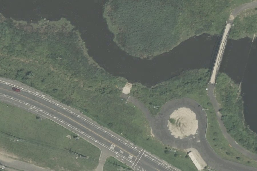
Cramer Hill Waterfront Park is a free public kayak and canoe launch on the Cooper River near Camden, New Jersey.
- Free
- Tidal
Harmful algal blooms reported on the water at this launch (state reports compiled by U.S. EPA): 2020.
state reports compiled by U.S. EPA · checked October 20, 2026
Status not reported No closure has been posted for this launch, but its agency does not publish open or closed status. Check with the managing agency before you tow.
At the launch
- Type
- Carry-in (canoe and kayak)
- Fee
- Free
- Tidal
- Yes
- Coordinates
- 39.95154, -75.10847
Conditions
- Weather forecast for this launch · National Weather Service
- Tide predictions at Pavonia, Cooper River, RR. bridge, N.J. · NOAA, 0.4 mi away
Tides
Predicted highs and lows at NOAA's Pavonia, Cooper River, RR. bridge, N.J. station, 0.4 mi from this launch, in local time above MLLW. Predictions, not observations: wind and weather move the real tide. Full predictions at NOAA.
| Mon Nov 2 | Low 2:09 am 0.7 ft · High 7:33 am 5.8 ft · Low 2:18 pm 0.7 ft · High 7:56 pm 6.6 ft |
|---|---|
| Tue Nov 3 | Low 3:06 am 0.6 ft · High 8:36 am 6.0 ft · Low 3:19 pm 0.7 ft · High 8:59 pm 6.6 ft |
| Wed Nov 4 | Low 4:02 am 0.4 ft · High 9:36 am 6.3 ft · Low 4:20 pm 0.6 ft · High 9:57 pm 6.6 ft |
| Thu Nov 5 | Low 4:55 am 0.3 ft · High 10:30 am 6.7 ft · Low 5:18 pm 0.5 ft · High 10:50 pm 6.6 ft |
| Fri Nov 6 | Low 5:45 am 0.2 ft · High 11:21 am 7.0 ft · Low 6:12 pm 0.4 ft · High 11:40 pm 6.6 ft |
| Sat Nov 7 | Low 6:32 am 0.2 ft · High 12:07 pm 7.2 ft · Low 7:04 pm 0.3 ft |
| Sun Nov 8 | High 12:26 am 6.5 ft · Low 7:16 am 0.2 ft · High 12:50 pm 7.2 ft · Low 7:52 pm 0.3 ft |
On Cooper River
River in New Jersey. All launches on Cooper River.
Community
Where people who use Cooper River talk about it.
Nearby launches
- Pyne Poynt Park · 0.5 mi · Delaware River
- Cooper Lake Boat Launch · 2.7 mi · Cooper River Lake
- Pennsauken Wildlife Management Area Boat Ramp · 3.0 mi · Frankford Creek
- Walnut Street Landing · 3.9 mi · Schuylkill River
- Gloucester City Municipal Marina · 4.0 mi
- Frankford Arsenal · 4.7 mi · Delaware River
Sources
- OpenStreetMap n10606435682 © OpenStreetMap contributors, ODbL
Why it is listed as public: www.camdencounty.com: Printable Map Sections from each launch below: From Pyne Poynt Park From Cramer Hill Waterfront Park. Something wrong, or is this launch private? Send a correction; it goes to a person.