
Connecticut River Carry-in Access
This is a public kayak and canoe launch on the Connecticut River near Tinkerville, Vermont.
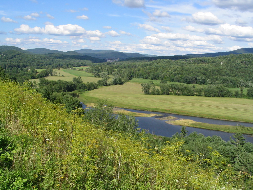
Status not reported No closure has been posted for this launch, but its agency does not publish open or closed status. Check with the managing agency before you tow.
At the launch
- Type
- Carry-in (canoe and kayak)
- Coordinates
- 44.77666, -71.59595
Directions (Google) Apple Maps
This launch has no official name in our sources; the name above describes where it is.
Conditions
- Weather forecast for this launch · National Weather Service
On Connecticut River
The Connecticut River is the longest river in New England. It forms the border between Vermont and New Hampshire, then crosses Massachusetts and Connecticut to reach Long Island Sound. The river rises at Fourth Connecticut Lake in Pittsburg, New Hampshire, and runs about 410 miles. Along the way it marks 255 miles of the New Hampshire–Vermont line and drops more than 2,480 feet before it reaches Massachusetts. Its watershed covers 11,260 square miles in five states and Quebec and is fed by 148 tributaries. In 1934 the state line was fixed at the low-water mark on the Vermont side, before the large hydroelectric dams were built. Because those dams widened the channel, Vermont's border now ranges from the shoreline itself to more than 500 feet out into the river. Moore and Comerford reservoirs flooded Fifteen-Mile Falls, and the Wilder, Bellows Falls and Vernon dams also impound the river along the Vermont shore. More about Connecticut River.
Boating rules on Connecticut River
- Headway speed within 150 feet of shore at boat launching sites in New Hampshire's jurisdiction (RSA 270:115) source
- 6 mph headway speed limit from the Ledyard Bridge in Hanover to 2,500 feet upstream; no towing of persons in that zone (RSA 270:120) source
- Headway speed for about 1,800 linear feet of river in Westmoreland, NH (SAF-C 402.151) source
Community
Where people who use Connecticut River talk about it.
Nearby launches
- Connecticut River - Francis John Smith · 0.1 mi · Connecticut River
- Debanville Landing · 2.5 mi · Connecticut River
- Riverside Park · 2.5 mi · Connecticut River
- Nulhegan River Carry-in Access · 2.6 mi · Nulhegan River
- Lemington Access · 4.2 mi · Connecticut River
- Wheeler Stream Carry-in Access · 4.8 mi · Wheeler Stream
Sources
- Vermont ANR Recreation Sites (boat launches and cartop launches on state parks, forests and wildlife lands) record {87038DE0-7FAB-405D-87A5-A3E8BF0130BD} · Vermont Open Geodata Policy v1.1 (no licence on the item); credit the Vermont Agency of Natural Resources, Department of Forests, Parks and Recreation
Why it is listed as public: listed by Vermont ANR Recreation Sites (boat launches and cartop launches on state parks, forests and wildlife lands). Something wrong, or is this launch private? Send a correction; it goes to a person.