
Massachusetts / Connecticut River /
Connecticut River Carry-in Access
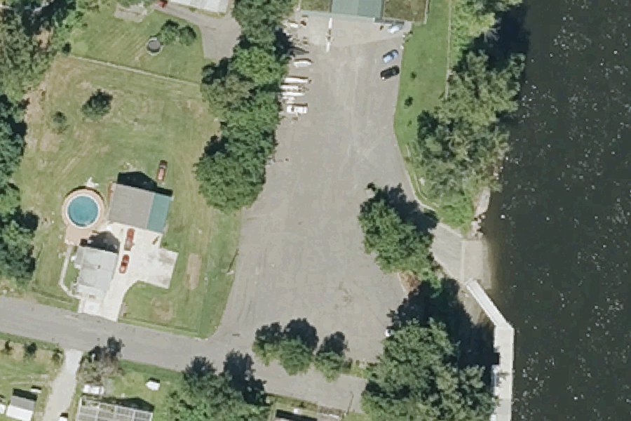
This is a public kayak and canoe launch on the Connecticut River near Holyoke, Massachusetts, run by MassWildlife.
Status not reported No closure has been posted for this launch, but its agency does not publish open or closed status. Check with the managing agency before you tow.
At the launch
- Type
- Carry-in (canoe and kayak)
- Ramp surface
- Concrete
- Managed by
- MassWildlife
- Coordinates
- 42.17204, -72.62970
Directions (Google) Apple Maps
This launch has no official name in our sources; the name above describes where it is.
Conditions
- Weather forecast for this launch · National Weather Service
- Water level, flow at the CONNECTICUT R AT I-391 BRIDGE AT HOLYOKE, MA gauge · USGS, 1.7 mi away on Connecticut River
Water level
Latest reading loads here; without it, see the USGS page below.
USGS gauge CONNECTICUT R AT I-391 BRIDGE AT HOLYOKE, MA, 1.7 mi from this launch on Connecticut River: water level, flow, a reading every 15 minutes. Readings and history at USGS.
On the river
- Falls, 4.2 mi upstream: South Hadley Falls. · USGS GNIS falls and rapids (The National Map Gazetteer)
Up to 10 river miles each way, from the agencies' inventories; not every hazard is listed and rivers change. Scout before you go.
Sources: USGS GNIS falls and rapids (The National Map Gazetteer).
On Connecticut River
The Connecticut River is the main river of the Pioneer Valley in western Massachusetts. It runs 410 miles from Fourth Connecticut Lake in Coos County, New Hampshire, to Long Island Sound at Old Saybrook and Old Lyme, Connecticut, and drains a basin of 11,260 square miles. On its way through Massachusetts it passes Northfield, Gill, Sunderland, Hatfield, Northampton, South Hadley, Holyoke, Chicopee and Springfield. Between Holyoke and South Hadley, the Holyoke Dam stands at Hadley Falls, where the river once fell 53 feet naturally. The dam is a granite gravity dam 1,020 feet long and 30 feet high. It opened in 1900 and is owned and operated by Holyoke Gas & Electric. Along the river, the Massachusetts Department of Conservation and Recreation manages Connecticut River Greenway State Park, which covers 1,048 acres and 12 miles of protected shoreline. More about Connecticut River.
Boating rules on Connecticut River
Community
Where people who use Connecticut River talk about it.
- Connecticut River Conservancy Association
- Connecticut River Conservancy (Facebook) Facebook
- Office of Fishing and Boating Access Agency
- Pioneer Valley Riverfront Club (Springfield) Club
- Pioneer Valley Yacht Club, Longmeadow Club
- Connecticut River Paddlers' Trail maps & guides Link
- Boating on the Connecticut River (Northampton MA) - iboats Boating Forum Forum
- Search Reddit: r/massachusetts Reddit
- Search all of Reddit for Connecticut River, Massachusetts Reddit
Nearby launches
- Connecticut River Boat Launch · 1.3 mi · Connecticut River
- Connecticut River Boat Launch · 3.3 mi · Connecticut River
- Pequot Pond Boat Launch · 3.5 mi · Pequot Pond
- Buck Pond Carry-in Access · 3.8 mi · Buck Pond
- Westfield River Carry-in Access near Agawam · 5.7 mi · Westfield River
- Arm Brook Reservoir Carry-in Access · 5.9 mi · Arm Brook Reservoir
Sources
- MassWildlife GoFishMA! freshwater access points record GFACC613 · Public data (MassWildlife, Massachusetts Division of Fisheries and Wildlife), no license stated
Why it is listed as public: listed by MassWildlife GoFishMA! freshwater access points. Something wrong, or is this launch private? Send a correction; it goes to a person.