
New Hampshire / Connecticut River /
Lancaster Boat Ramp
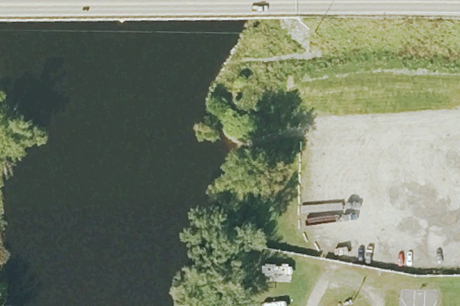
Lancaster Boat Ramp is a free public boat ramp on the Connecticut River near Lancaster, New Hampshire.
- Free
- Restrooms
Status not reported No closure has been posted for this launch, but its agency does not publish open or closed status. Check with the managing agency before you tow.
At the launch
- Type
- Boat ramp
- Fee
- Free
- Ramp surface
- Gravel
- Car parking
- Gravel
- Restrooms
- Yes
- Coordinates
- 44.49585, -71.59386
Conditions
- Weather forecast for this launch · National Weather Service
- Water level, flow at the CONNECTICUT RIVER NEAR DALTON, NH gauge · USGS, 8.6 mi away on Connecticut River
Water level
Latest reading loads here; without it, see the USGS page below.
USGS gauge CONNECTICUT RIVER NEAR DALTON, NH, 8.6 mi from this launch on Connecticut River: water level, flow, a reading every 15 minutes. Readings and history at USGS.
On Connecticut River
The Connecticut River is the longest river in New England. It rises at Fourth Connecticut Lake near the Canadian border and flows 406 miles through four states to Long Island Sound. Within Pittsburg it runs through the remaining Connecticut Lakes and Lake Francis. It then forms 255 miles of the New Hampshire–Vermont border, which follows the river's western bank at the normal high-water mark rather than its centerline. The river drops more than 2,480 feet between Pittsburg and the Massachusetts line. Its watershed covers about 11,250 square miles, 3,046 of them in New Hampshire. Dams on the main stem, starting at Lake Francis Dam in Pittsburg, turn much of the river into a series of slow-flowing basins. New Hampshire added the river to its Rivers Management and Protection Program in July 1992. More about Connecticut River.
Boating rules on Connecticut River
- Headway speed within 150 feet of the shoreline, posted at all boat launching sites on New Hampshire waters of the river (RSA 270:115) source
- Headway speed (6 mph) and no towing between the Ledyard Bridge in Hanover and a line 2,500 feet north of it (RSA 270:120) source
- Headway speed along an approximately 1,800-foot stretch in Westmoreland (SAF-C 402.151) source
- Great River Hydro recreation facilities open day-use only, from a half hour before sunrise to a half hour after sunset source
Community
Where people who use Connecticut River talk about it.
- Connecticut River Conservancy Association
- Connecticut River Conservancy (Facebook) Facebook
- Connecticut River Joint Commissions Association
- Connecticut River Paddlers Trail Association
- Wilder Hydroelectric Project Recreation - Great River Hydro Agency
- Waterline - Wilder Station flows Link
- Search Reddit: r/newhampshire Reddit
- Search all of Reddit for Connecticut River, New Hampshire Reddit
Nearby launches
- Martin Meadow Pond Launch · 3.9 mi · Martin Meadow Pond
- Mt. Orne Covered Bridge Access · 3.9 mi · Connecticut River
- Neal Pond Boat Launch · 4.9 mi · Neal Pond
- Wyoming Dam Access · 5.0 mi · Connecticut River
- Dalton Boat Launch · 6.3 mi · Connecticut River
- Mirror Lake Boat Launch · 7.7 mi · Mirror Lake
Sources
- NH Fish and Game Access Sites to Public Waters (hosted copy) record 5024 · Public record (NH Fish and Game Department and NH Office of Planning and Development), no license stated
- OpenStreetMap n1486102328 © OpenStreetMap contributors, ODbL
Why it is listed as public: listed by NH Fish and Game Access Sites to Public Waters (hosted copy). Something wrong, or is this launch private? Send a correction; it goes to a person.