
Massachusetts / Charles River /
Charles River Carry-in Access near Needham
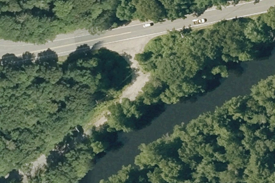
This is a public kayak and canoe launch on the Charles River near Needham, Massachusetts, run by MassWildlife.
Status not reported No closure has been posted for this launch, but its agency does not publish open or closed status. Check with the managing agency before you tow.
At the launch
- Type
- Carry-in (canoe and kayak)
- Ramp surface
- Dirt
- Managed by
- MassWildlife
- Coordinates
- 42.26967, -71.19639
Directions (Google) Apple Maps
This launch has no official name in our sources; the name above describes where it is.
Conditions
- Weather forecast for this launch · National Weather Service
- Water level, flow at the CHARLES RIVER AT DOVER, MA gauge · USGS, 3.4 mi away on Charles River
Water level
Latest reading loads here; without it, see the USGS page below.
USGS gauge CHARLES RIVER AT DOVER, MA, 3.4 mi from this launch on Charles River: water level, flow, a reading every 15 minutes. Readings and history at USGS.
On Charles River
The Charles River is an 80-mile river in eastern Massachusetts. It flows northeast from its source at Echo Lake in Hopkinton to Boston Harbor, winding through 23 cities and towns and doubling back on itself several times. The river drains 308 square miles, but its source is only 26 miles from its mouth, and it drops just 350 feet from source to sea. The watershed holds more than 8,000 acres of protected wetlands, called Natural Valley Storage, that help prevent flooding downstream. A dam at the river's mouth, finished in 1910, stabilized the water level from Boston to Watertown and removed the mud flats there. More about Charles River.
Boating rules on Charles River
- Maximum speed of 10 mph in the Charles River Basin source
- No wake within 50 yards of floats or of canoes, shells, rowboats, kayaks, sailboats or similar non-motorized vessels (Charles River Basin) source
- Controlled-wake area: motorized craft limited to 5 mph between the North Beacon Street Bridge and the Boston University Bridge source
- Boats over 30 feet may not moor in the Basin or upstream of the BU Bridge without DCR written authorization; mooring at a public landing is limited to 20 minutes source
- Car-top boats only at DCR Upper Charles launches including Elm Bank (Dover), Ames St./Pleasant St. and Riverdale Park (Dedham), Charles River Road, Hemlock Gorge and Quinobequin Road (Newton), and Redwing Bay (Needham) source
- Default 12 mph speed limit on DCR waters where no limit is posted source
- Moving aquatic invasive species into or out of DCR waters is prohibited source
Community
Where people who use Charles River talk about it.
- Charles River Watershed Association (CRWA) Association
- Charles River Conservancy Association
- Charles River Alliance of Boaters (CRAB) Club
- Charles River Watershed Association (Facebook) Facebook
- Charles River Alliance of Boaters (Facebook) Facebook
- Charles River Conservancy (Facebook) Facebook
- Charles River Canoe Launch Sites Located In Millis - Millis Conservation Commission Agency
- Charles River - US EPA (water quality data) Link
- Boating in the Charles River - The Hull Truth forum Forum
- Search Reddit: r/massachusetts Reddit
- Search all of Reddit for Charles River, Massachusetts Reddit
Nearby launches
- Charles River Carry-in Access · 0.8 mi · Charles River
- Charles River Carry-in Access · 0.9 mi · Charles River
- Needham Reservoir Carry-in Access · 1.2 mi · Needham Reservoir
- Kendrick Pond Carry-in Access · 2.0 mi · Kendrick Pond
- Nahanton Park, Newton · 2.1 mi · Charles River
- Rosemary Lake Carry-in Access near Needham · 2.4 mi · Rosemary Lake
Sources
- MassWildlife GoFishMA! freshwater access points record GFACC396 · Public data (MassWildlife, Massachusetts Division of Fisheries and Wildlife), no license stated
Why it is listed as public: listed by MassWildlife GoFishMA! freshwater access points. Something wrong, or is this launch private? Send a correction; it goes to a person.