
Bocilla Island Seaport and Fishing Pier
Bocilla Island Seaport and Fishing Pier is a public boat ramp on Back Bay near Bokeelia, Florida, run by Private Business.
- $20
- 1 lane
- 24 trailer spaces
- Paved ramp
- Tidal
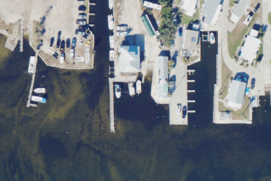
Open per Florida Boat Ramp Inventory (FWC)'s data, checked October 15, 2026. Seasonal gates, low water and storms are not always posted; check before you tow.
At the launch
- Type
- Boat ramp
- Fee
- $20
- Ramp lanes
- 1
- Ramp surface
- Concrete
- Trailer parking
- 24 spaces
- Hours
- 7:00 AM to 7:00 PM
- Tidal
- Yes
- Managed by
- Private Business
- Website
- bokeeliafishingpier.com
- Coordinates
- 26.70425, -82.16352
Conditions
- Weather forecast for this launch · National Weather Service
- Tide predictions at Bokeelia, Charlotte Harbor · NOAA, 0.2 mi away
Marine advisories
Advisories in effect load here; without them, see the NWS zone forecast below.
National Weather Service marine zone GMZ836, Charlotte Harbor and Pine Island Sound. Zone forecast: winds, seas, warnings.
Tides
Predicted highs and lows at NOAA's Bokeelia, Charlotte Harbor station, 0.2 mi from this launch, in local time above MLLW. Predictions, not observations: wind and weather move the real tide. Full predictions at NOAA.
| Mon Nov 2 | High 6:23 am 1.9 ft · Low 2:52 pm 0.3 ft · High 10:55 pm 1.3 ft |
|---|---|
| Tue Nov 3 | Low 2:07 am 1.2 ft · High 7:54 am 1.7 ft · Low 3:34 pm 0.5 ft · High 10:38 pm 1.4 ft |
| Wed Nov 4 | Low 3:37 am 1.0 ft · High 9:23 am 1.6 ft · Low 4:10 pm 0.6 ft · High 10:33 pm 1.5 ft |
| Thu Nov 5 | Low 4:45 am 0.7 ft · High 10:45 am 1.5 ft · Low 4:40 pm 0.8 ft · High 10:47 pm 1.7 ft |
| Fri Nov 6 | Low 5:42 am 0.5 ft · High 12:00 pm 1.4 ft · Low 5:05 pm 1.0 ft · High 11:09 pm 1.8 ft |
| Sat Nov 7 | Low 6:31 am 0.3 ft · High 1:13 pm 1.3 ft · Low 5:25 pm 1.1 ft · High 11:35 pm 2.0 ft |
| Sun Nov 8 | Low 7:16 am 0.2 ft · High 2:33 pm 1.3 ft · Low 5:42 pm 1.2 ft |
On Back Bay
Bay in Florida. All launches on Back Bay.
Community
Where people who use Back Bay talk about it.
Nearby launches
- Stringfellow Road Right-of-Way Jug Creek Kayak Access · 0.6 mi · Charlotte Harbor
- Lavender's Landing / Bokeelia Public Boat Ramp · 1.3 mi · Charlotte Harbor
- Fritz Park Calusa Land Trust Kayak Access (High Tide Only!) · 1.9 mi · Big Jim Creek Preserve
- Pineland Monument Park Paddlecraft Launch · 3.2 mi · Pine Island Sound
- Cayo Costa State Park Canoe/Kayak Launch · 5.2 mi · Charlotte Harbor
- Boca Grande Lighthouse Paddle Launch · 6.0 mi · Charlotte Harbor
Sources
- Florida Boat Ramp Inventory (FWC) record LE67733FD · Open data; credit to FWC-FWRI requested
- Florida DEP Circumnavigational Saltwater Paddling Trail kayak launches record -82.16425,26.70450 · FDEP: relative location reference only, not a survey; credit FDEP Office of Greenways and Trails and the Florida Paddling Trail Association
- OpenStreetMap n3010083027 © OpenStreetMap contributors, ODbL
- OpenStreetMap n3010083028 © OpenStreetMap contributors, ODbL
Why it is listed as public: web.archive.org: BOAT RAMP OPEN EVERYDAY $20 to launch and park per day.. Something wrong, or is this launch private? Send a correction; it goes to a person.